

With a zoom lens, clear day, and small plane, John Wiley checked on some SB County reservoirs and sent Ed these pix.
Jameson was overflowing down the steep stairsteps of the dam. I wonder if one of those sensors atop the dam with antennae is updating the County’s rainfall website.
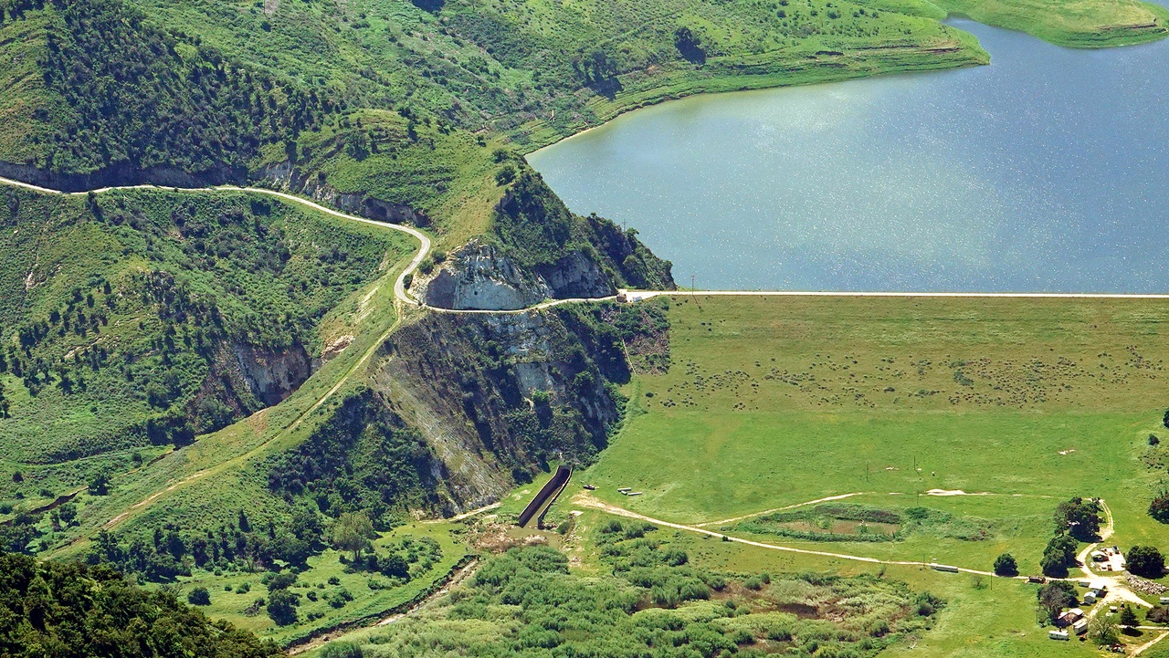
Lopez Lake had more water again from the mid-March storm. The surrounding terrain is so lush compared with during the drought!
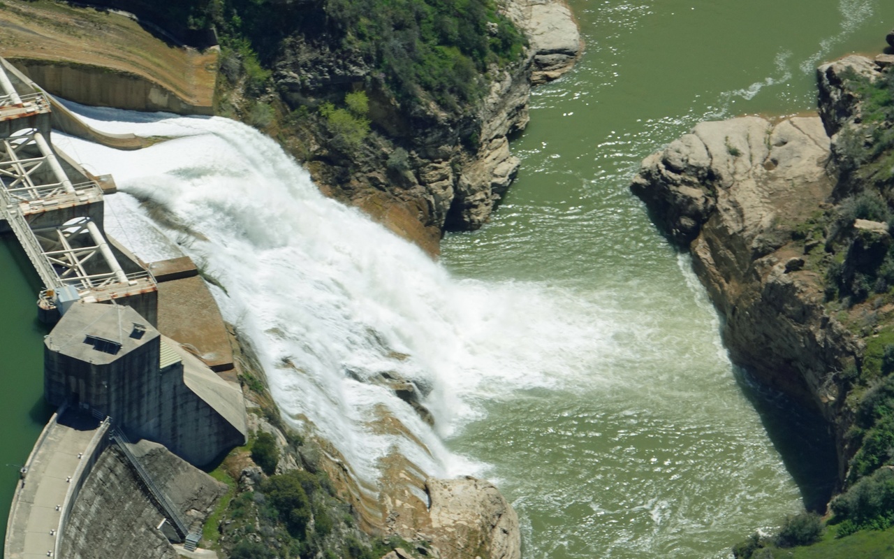
Gibraltar was full and spilling vigorously, making for a massive fantail and plume of mist. Guess there’s not much access upstream on the road to the dam?
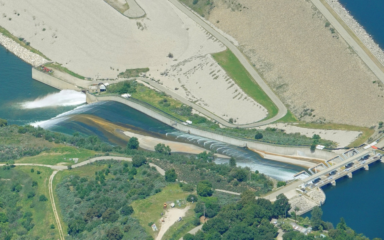
Many of us have seen Cachuma spilling lately, though fewer from this vantage point. The gates are all up with most water coming out down at the base, so does this mean it’s already below 100% now?
Anyone interested to see the many varied and much larger wildflower blooms we saw in another area not too far from there?


John, the county has a transducer on Juncal dam (Jameson res) to relay stage of lake, while the county rain gauge is over by the multiple arch dam. While Juncal dam and San Francisquito dams look similar and were built at roughly the same time, Juncal dam is a fraction the size. Luckily for me (I live downstream) Juncal dam was built in solid sandstone bedrock. There is a recently published book (Floodpath) that goes into great detail about the history of William Mulholland and the catastrophe of the dam collapse that ended his career.
Thanks for the sensor details, Terrapin. Edhat is such a great info source! I’m glad the bedrock is solid, and presumably leak-proof so as to maintain sandstone integrity. The PBS dam disaster docu is fascinating and scary, maybe somewhat of a parallel with recent Boeing issues.
That powerful “fantail” leaping over Gibraltar makes a thundering roar I’ll bet! Anyone here ever heard it?
That pool below Gibraltar Dam is one awesome swimming spot on a quiet sunny day. Not today though!
Are Jameson in the 1st pic and the 1928 dam disaster above Castaic the same design? We happened to see a few minutes of PBS’ “Flood in the Desert” last night, and I literally thought it was Jameson under construction. Obviously our version of that design is solid, presuming it was built around the same time. 🙂 There’s a wiki about the 1928 disaster (devastation all the way from Magic Mountain to the beach near Ventura).
https://en.wikipedia.org/wiki/St._Francis_Dam
Interesting read there JW, thanks for sharing that. What a story. I like the part where the folks out of Inyo were dynamiting parts of the aqueduct to prevent LA from stealing Sierra water.
Love these pictures! Thanks.
I know you know where to find the reservoir info 😉
https://files.countyofsb.org/pwd/hydrology/Rainfall%20Reports/rainfallreport.pdf
According to the County rainfall/reservoir website, Cachuma was at 100.7% of capacity on April 20, 12:45 PM
Love all the pics, thanks John!!
Yes please John for the wildflower photos!
Ed has so many great pix and interesting articles recently, they may not have time/space to post them. I hope someone will tour New Cuyama (or already has) to give a report in a Comment and send Ed details w/pix from the ground.
Power of Mother Nature in full effect — great photos
Yes please to seeing the blooms🌻🌻🌻
The bloom is in New Cuyama. I sent Ed some pix, but want to let anyone know who’s contemplating a wildflower trip to check it out on the ground and report back. I can tell you our aerial perspective was beautiful, though we didn’t take the time to explore on the ground. Any pilots interested can rest assured the new runway surface is great, though parking could use improvement (we shut down, coasted to the ramp and pushed rather than taxi due to some loose FOD).
“Lopez” Lake (2nd pic) is of course Twitchell Reservoir. Somehow years ago I got that name wrong and occasionally switch it again. Oops. 😐