

The repeating “water cycle” can be interesting. Say you start with this snow we saw lingering atop the Sierra Madre a few minutes’ flight from SBA a week ago.
I think of “solid state” water like that, as cold and sometimes (ice) hard. Then there’s comfortable, soft liquid water (usually just called “water”) flowing over this hard rock and actually cutting grooves in it below a Highway 154 bend.
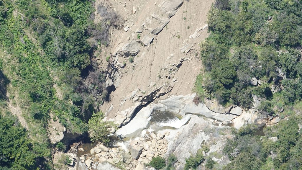
Rain water falling there had brought down mud, gravel and new boulders but the strong flow in this channel had already cleared some of that away.
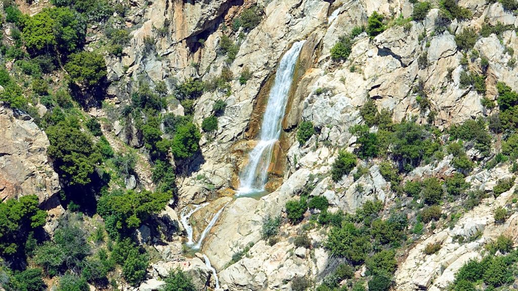
Over at Tangerine Falls, the water has carved a deep pool in solid rock at the bottom.
A lot of the water trickling down from melting snow or falling from the sky as snow or rain brings bright colors to the land in leaves and flowers. Other droplets soak deep down into the ground where they may stay quietly for a very long time. Some water reaches all the way to the ocean, staying for many years leaping in storms or diving deep, and possibly traveling the world.
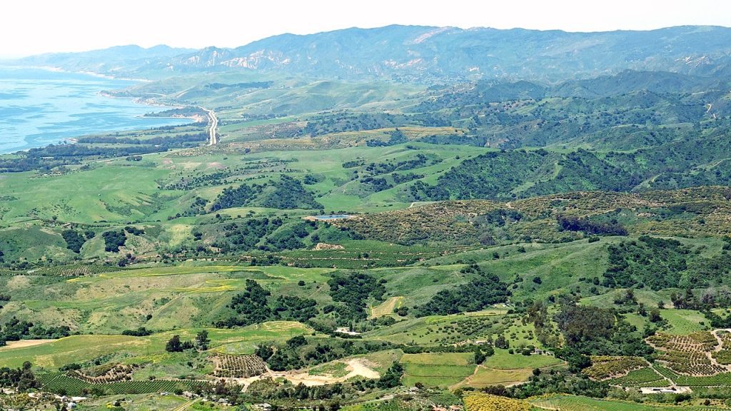
Eventually all those influences of gravity yield, when water enters its gas state and rises again into the air to wander. You can see that actually happening in the pic above, as blue or white haze in the air. Will that water eventually leave the air again, perhaps atop that mountain – or our heads?


Ever imagine quietly enjoying cool water below the busy 154 bend? We’ve never seen anyone there, and don’t know of any easy access. Plus I gather it’s on private property. Sure is a fascinating feature where pools and deep grooves have been carved into the rock. Anyone who’s been there have pix to share?
Hey John, Really love the pics thanks for sharing! I think you’re looking at Lower Tier Drop and it is on private property. Amazing spot 🙂
Thanks Ando! Great having a name for such a magnificent secret place. It’s about a mile East of the Painted Cave turnoff and below 154 near the small unmarked road to newish homes on the upper side of 154. Quite a steep ravine that doesn’t seem to have a name despite there being water down in those pools every time we’ve seen it from the air. Even running water at the depths of our last drought. Any idea how it got the name Tier Drop? I guess because there are distinct different pools and grooves in the rock at different levels? I get the sense maybe you’ve been there.
Hi John, is there a way to private message you? Thanks!
While of course busy, Ed has kindly forwarded PMs. A more direct method would be via the Contact form on our blog https://ja4u.NET/
Anyone want to guess what the small dots are on the rock at the bottom of the Tangerine Falls pic?
Is that a ridgeline hiking trail or a game trail in the snowy peak pic?
We’ve never made the arduous scramble up the boulders or taken the trail from the Gibraltar Rd. bend to Tangerine Falls. I wish we had, and would enjoy seeing pix on Edhat from those who have.