

Mission Ridge is the most challenging hike I lead and I was happy to be leading it again for the Humanist Society of Santa Barbara earlier this month. We had eleven happy, energetic hikers. I like to lead this around New Year’s each year. But last year I had to cancel it because of the endless January storms. And this year it got delayed a month for the same reason.
The biggest challenge on this hike? Finding parking at the trailhead! When I started hiking here 40 years ago there were plenty of spaces on both sides of Tunnel Road. But property owners have placed obstructions in the parking along the road, especially on the down hill side. Making it difficult to find a space.
I had tried doing the hikes earlier, but that did not help. This time, I decided we would start later, at 10AM. That helped. There were cars parked far down Tunnel Road, but at least there was a chance to snag a spot from someone who had finished an early hike and had just left.
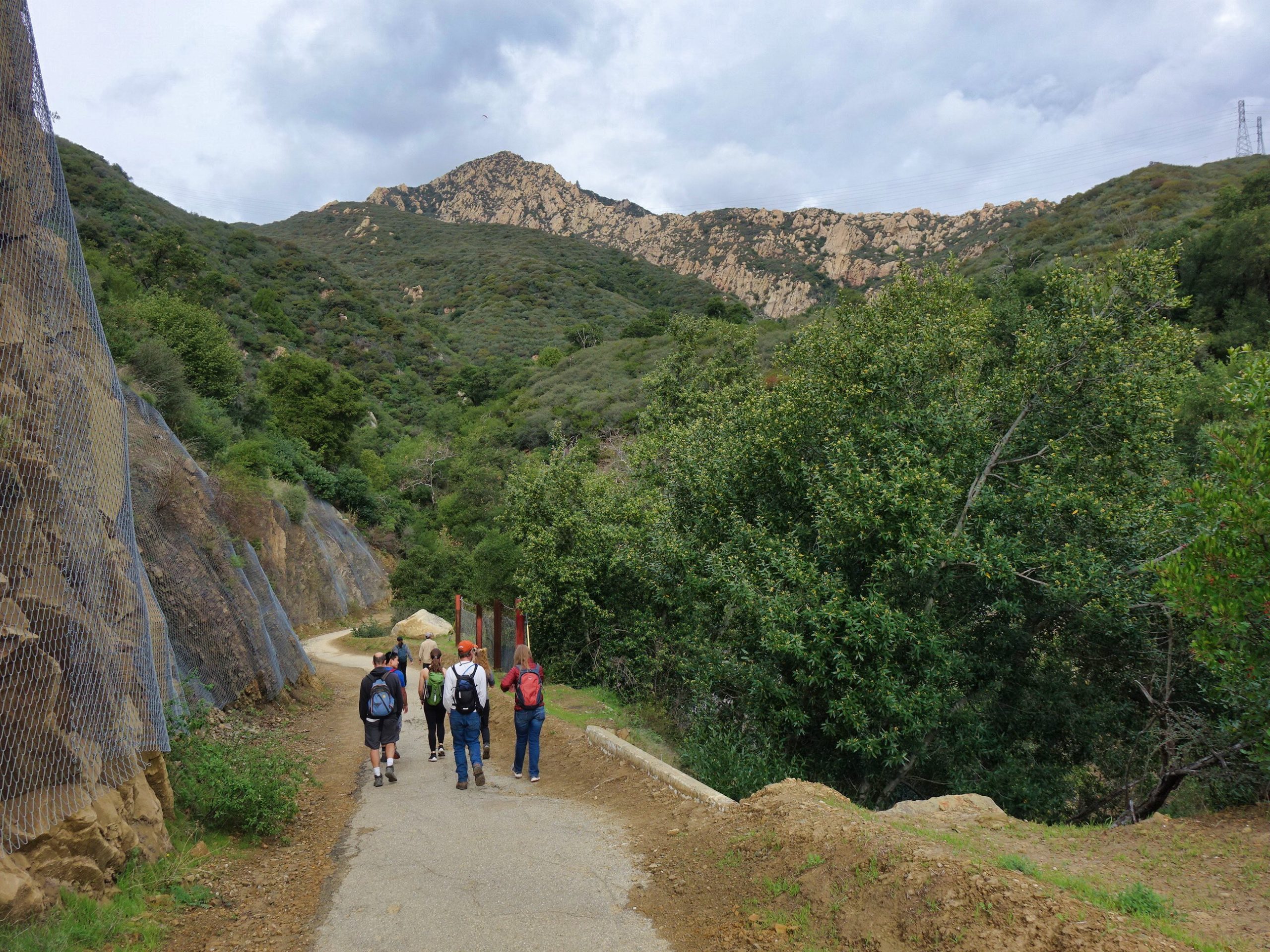
Here we were heading on the paved service road. You can see the nets to catch falling debris. Up above is the “Dragon’s Back” of Arlington Peak. I would like to lead a hike there again if we can deal with the parking.
Here we paused for a group photo on the Tunnel Trail near one of the Edison power towers. There is a connector trail from near this spot that goes down to the Edison service road below.
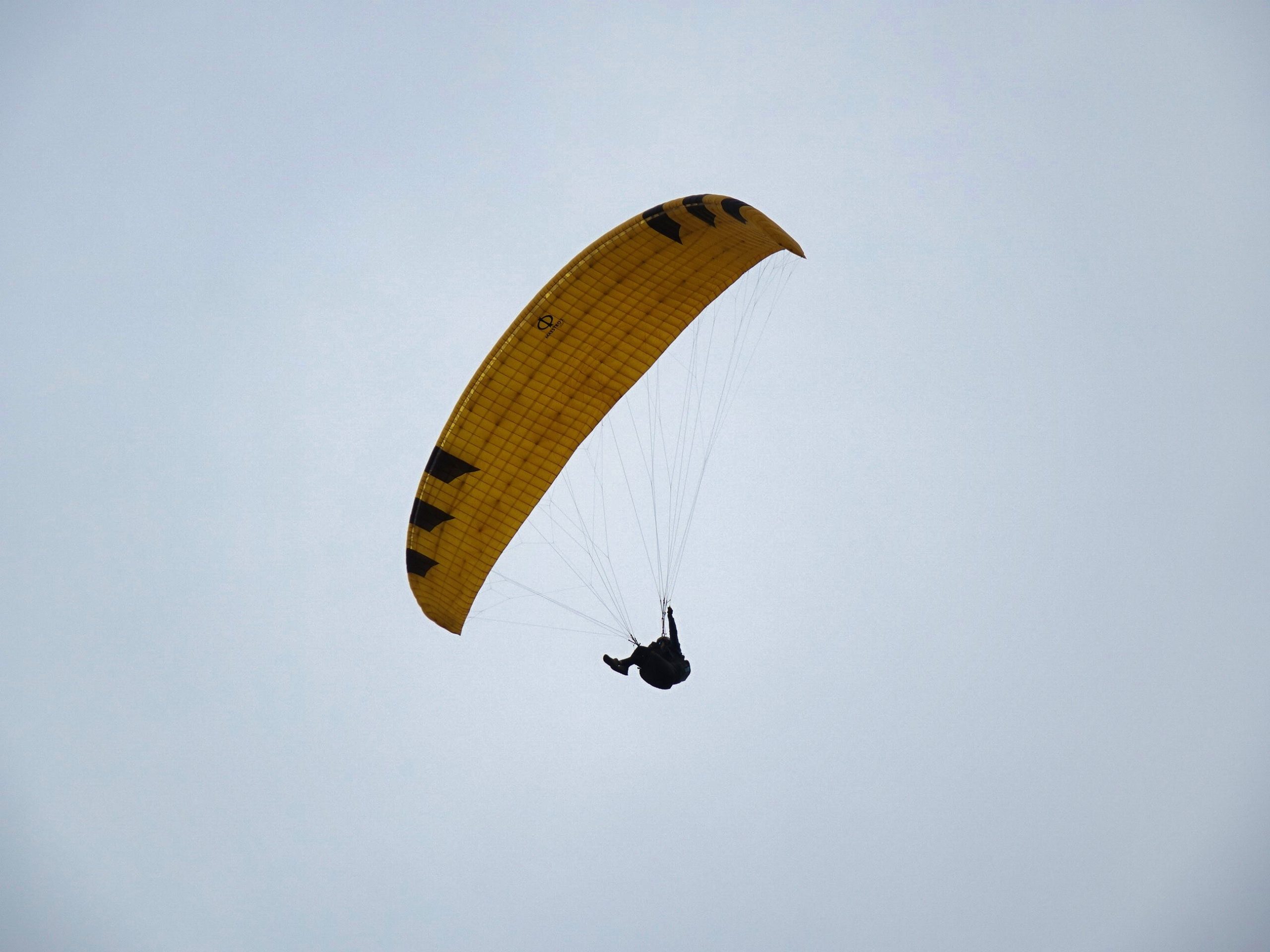
We were soon treated to this majestic view of paragliders sailing near Mission Ridge.
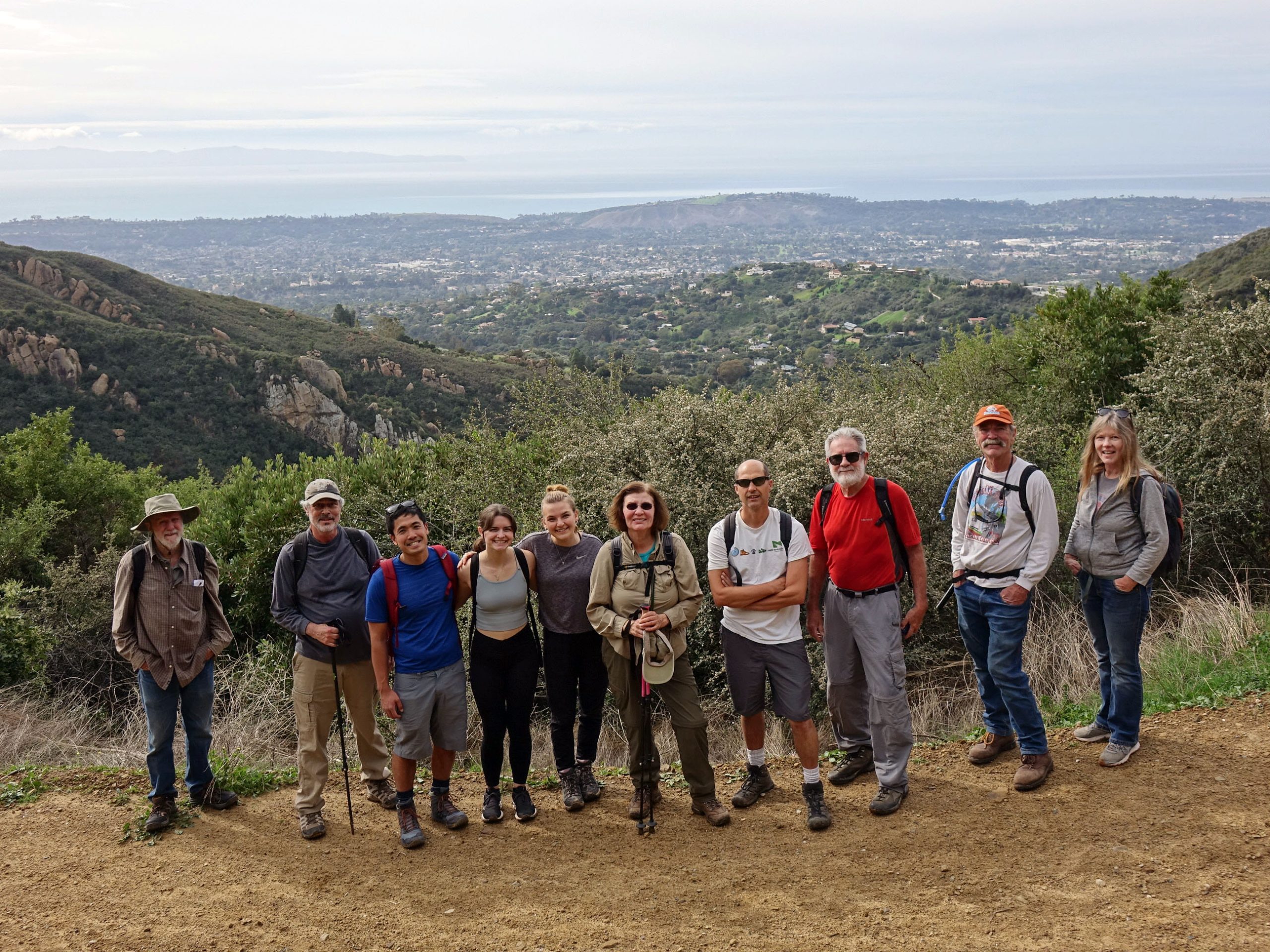
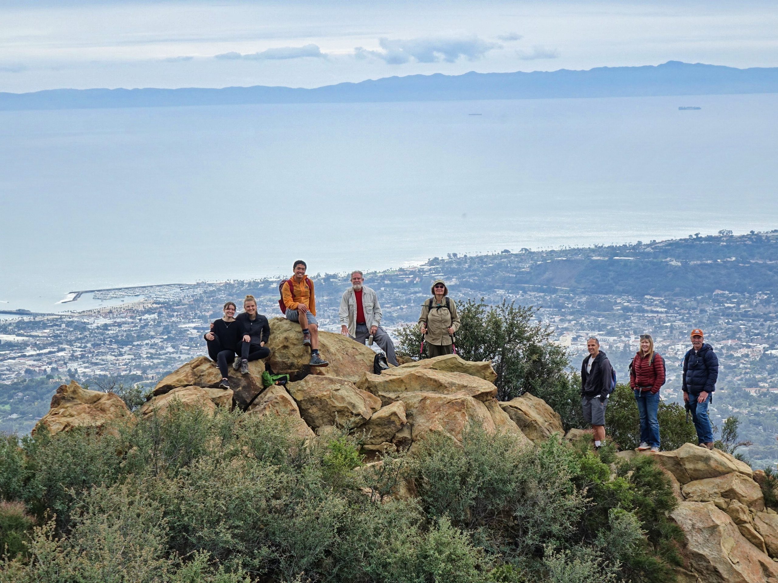
As we climbed higher on the Tunnel Trail it was time for another group photo. You can see the Arlington Peak Dragon’s Back beyond, on the far side of the Mission Creek canyon. Cathedral Peak is off to the right of Arlington Peak.
Here is another view as we climbed a bit higher. The weather was just perfect, ahead of a huge storm that rolled in later that day. The air was still, the temperature was perfect for hiking and there were dramatic, billowy clouds in the sky!
Here we were looking out over Inspiration Point and out to UCSB and the Airport way beyond that. The Lauro Reservoir is down below Inspiration Point on the left.
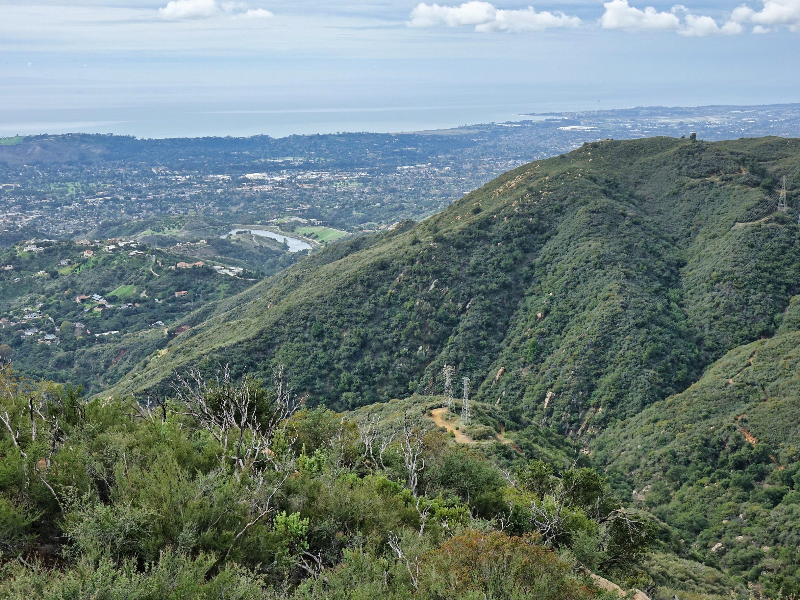
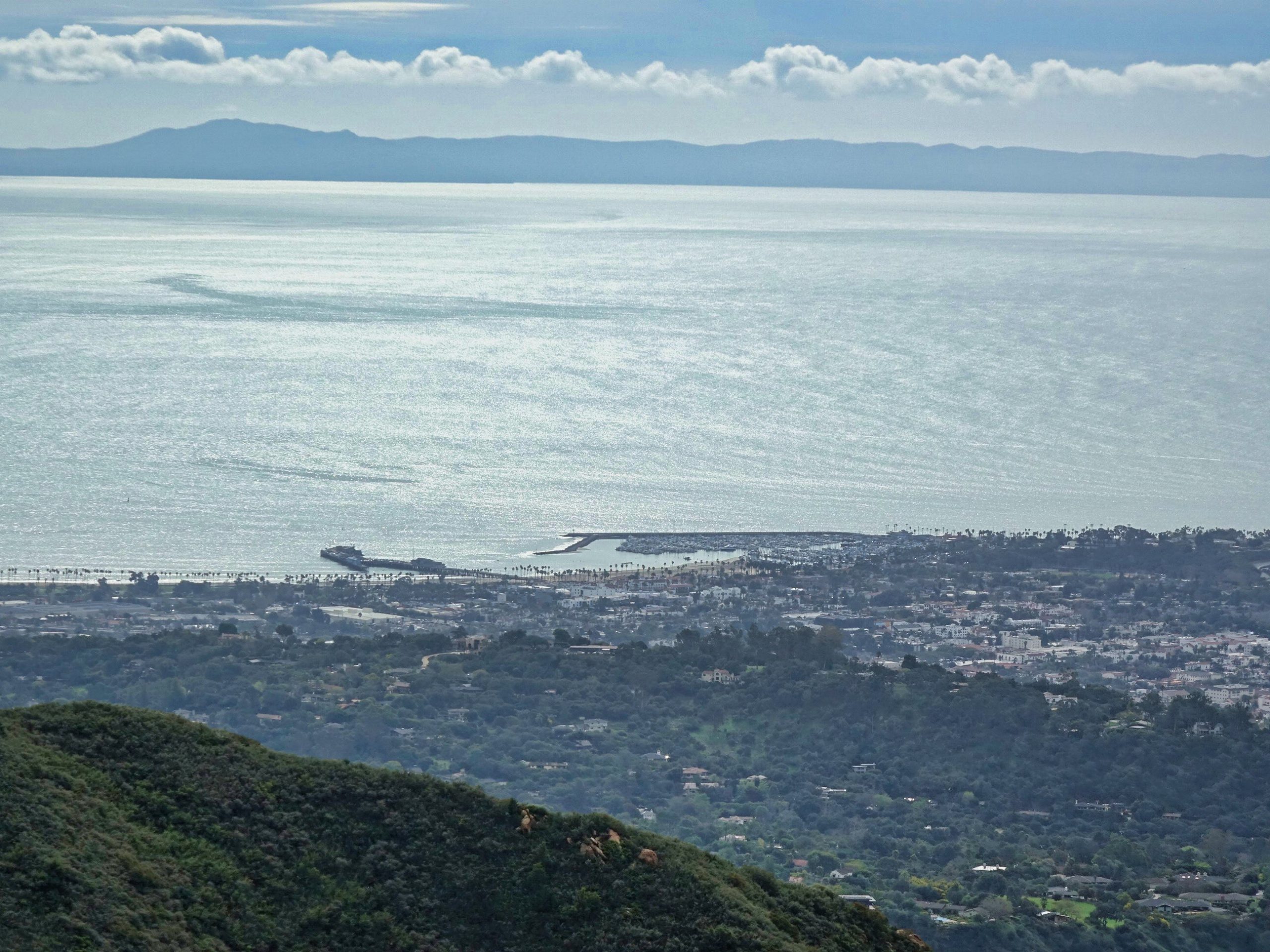
Here we looked down at Stearns Wharf and downtown Santa Barbara.
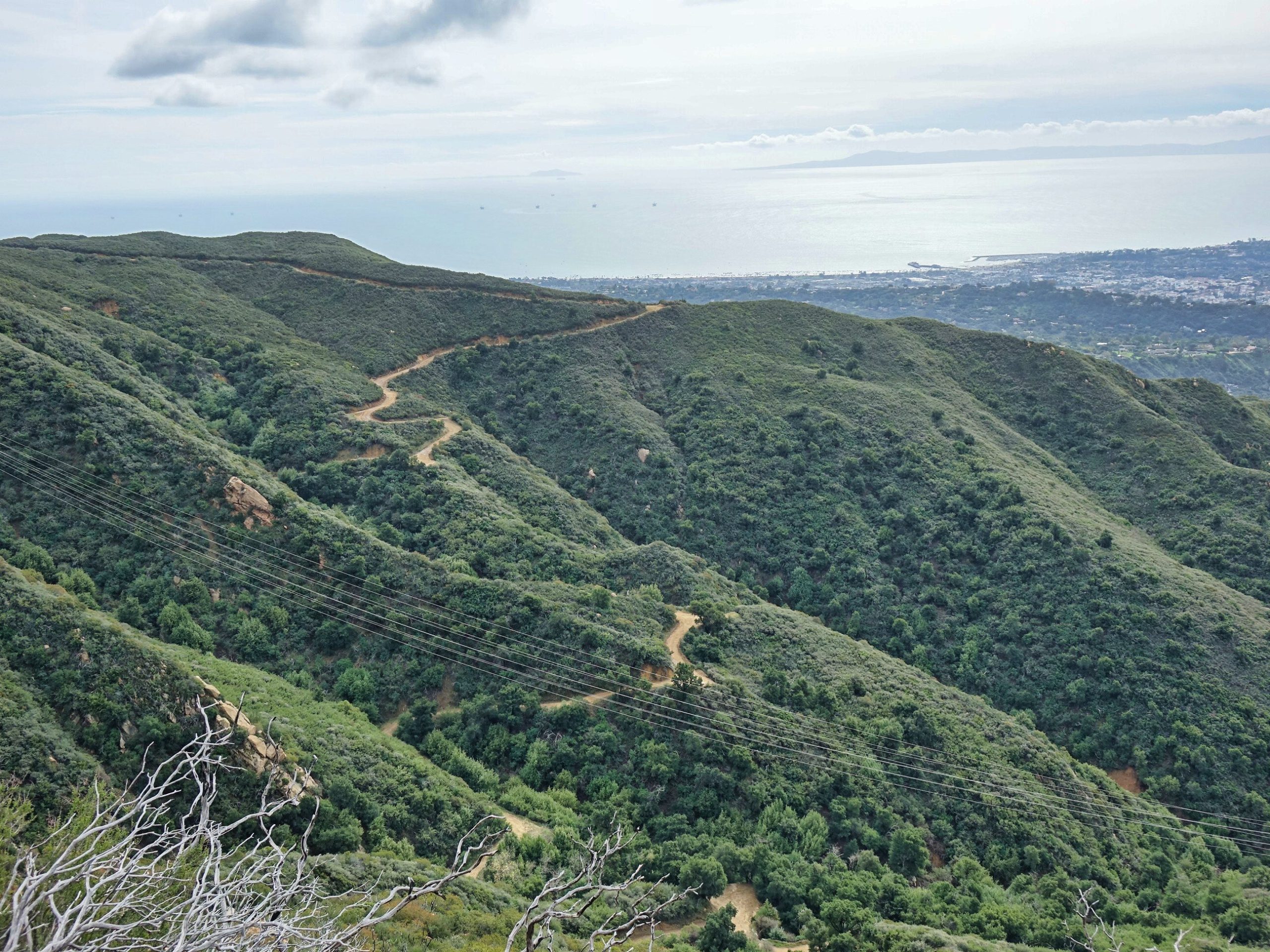
That fire road is the Edison service road that we would be returning on from the east end of Mission Ridge.
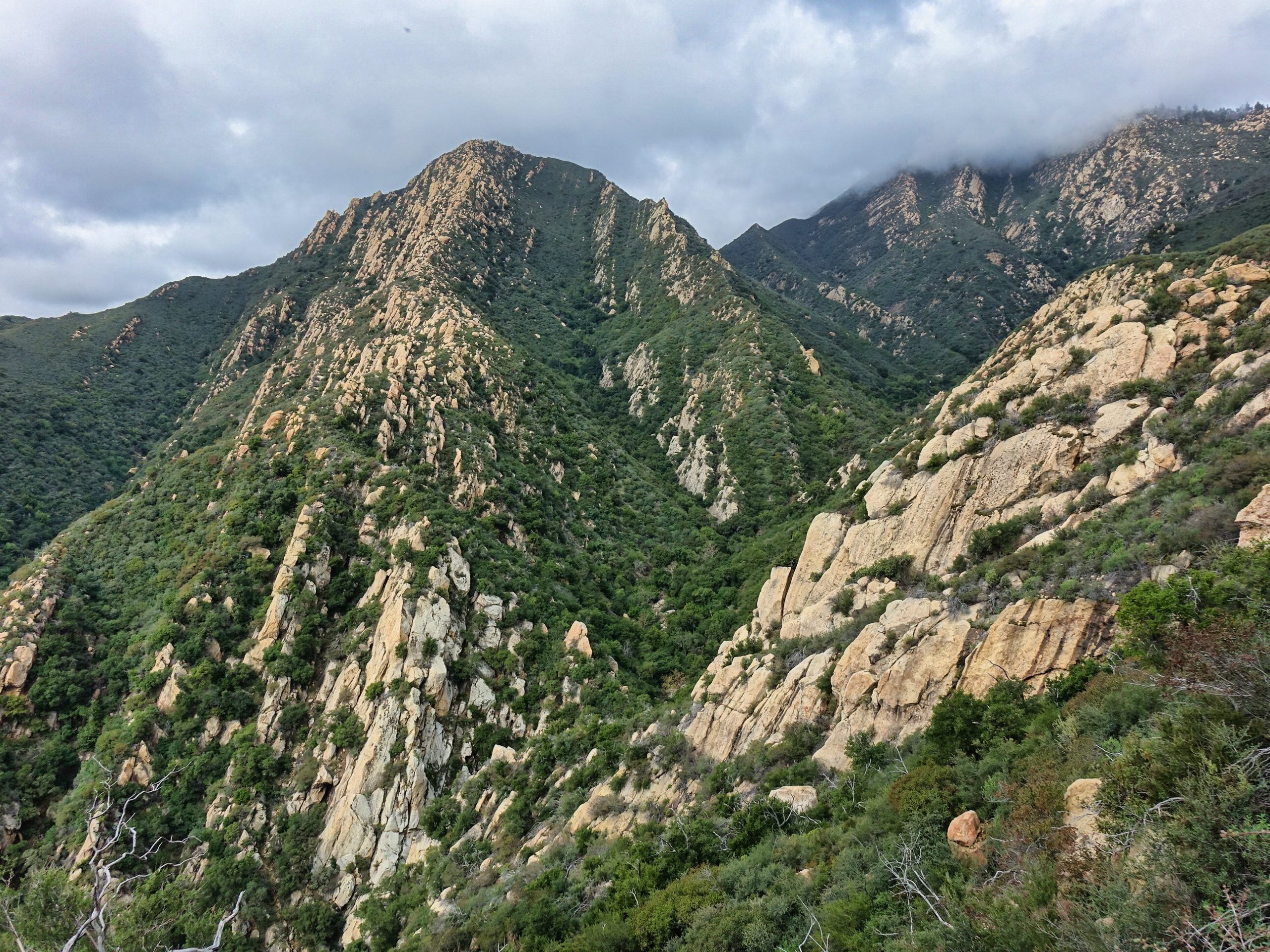
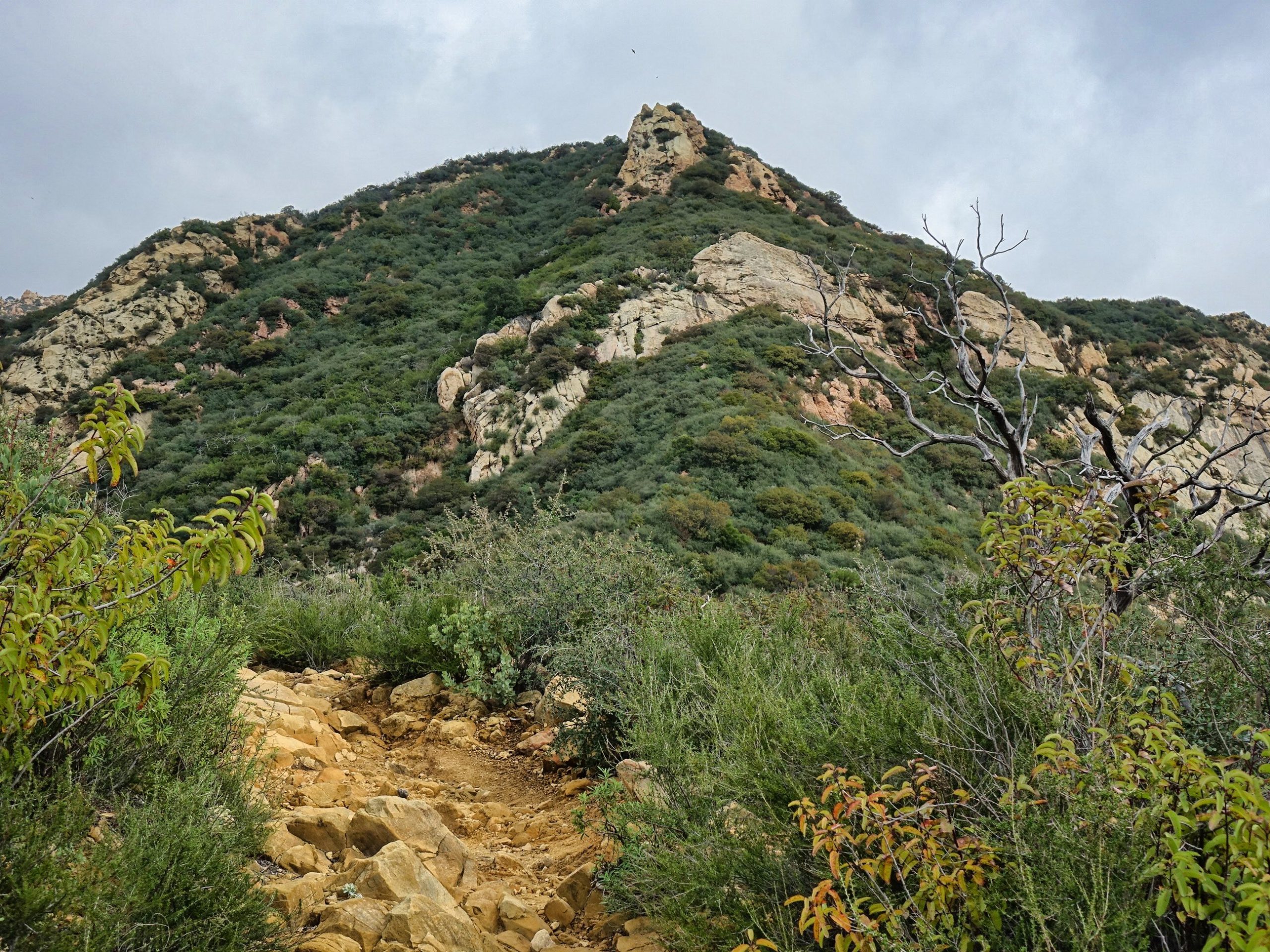
That peak straight ahead is the top of Mission Ridge and would be our lunch spot. Not as close as it looks, though! We still have some more climbing and rock scrambling to get there!
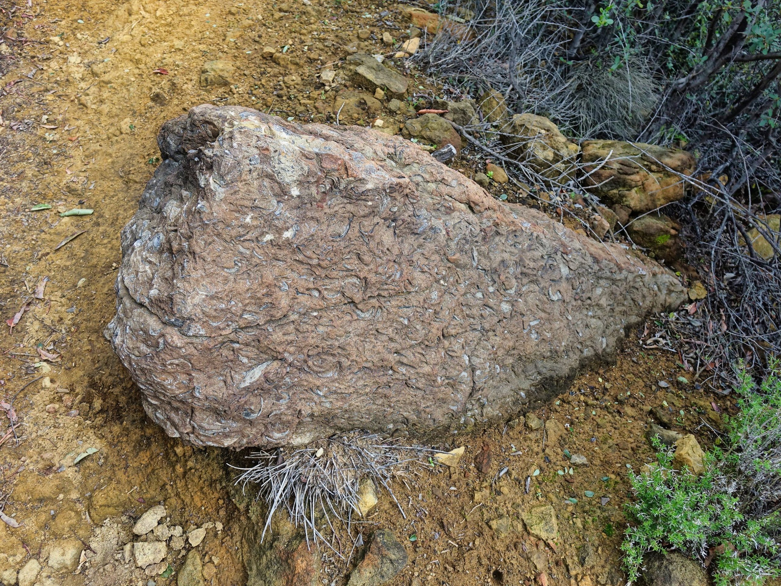
Tom Farr is a local geologist who often comes on my hikes. He is very helpful at pointing out and explaining interesting geological finds. Like these fossils that used to be in the ocean.
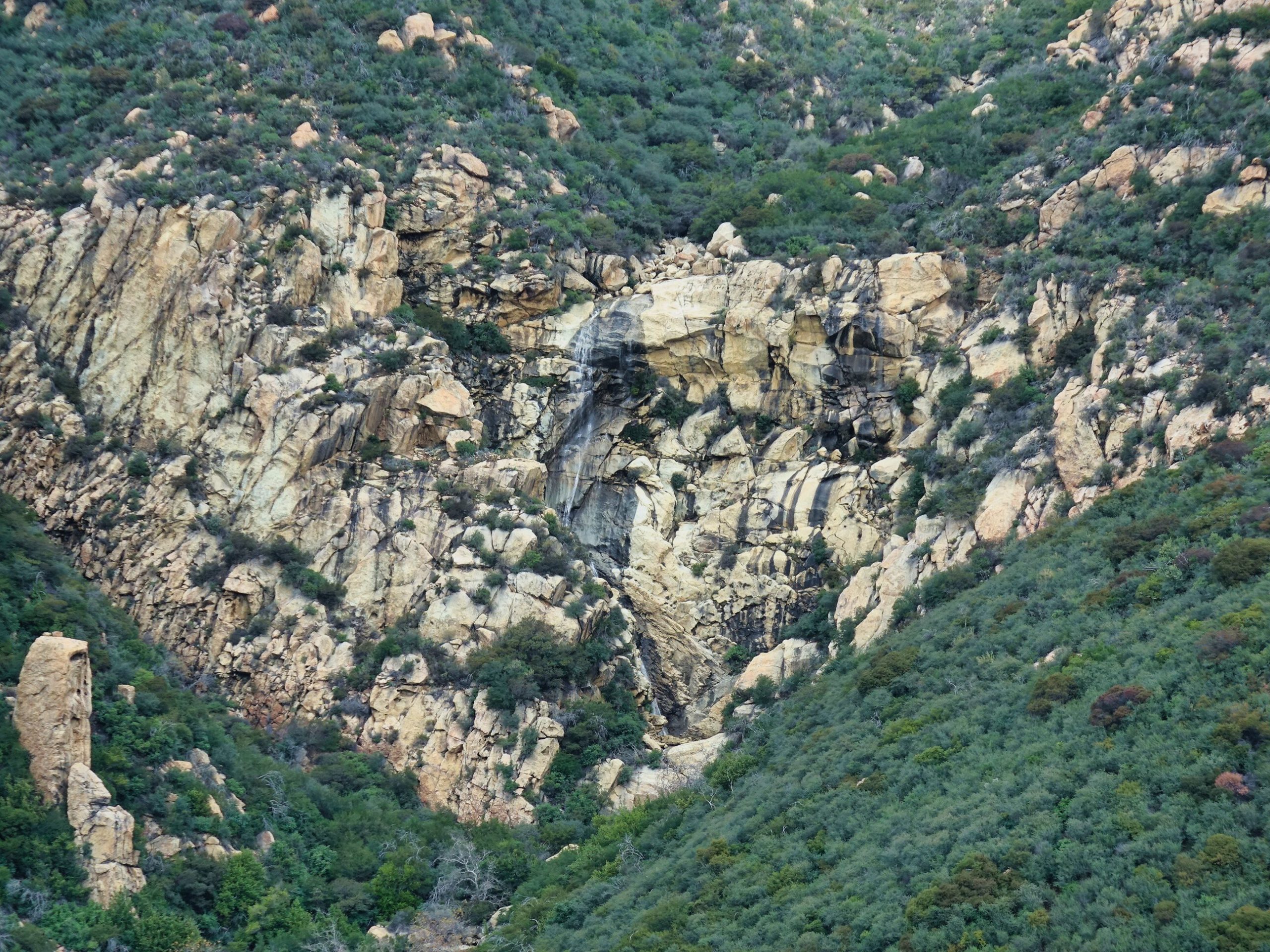
We finally reached the point on the Tunnel Trail where we would begin our scramble up to Mission Ridge. This is just a bit before the Rattlesnake Connector Trail. Just beyond this point is a waterfall that is dry most of the time. As fellow hike leader Tony Biegen once explained to me: It has no watershed. Meaning water only flows when it is actually raining, or for a few days after. Here you can see that falls flowing, which indeed is a rare sight!
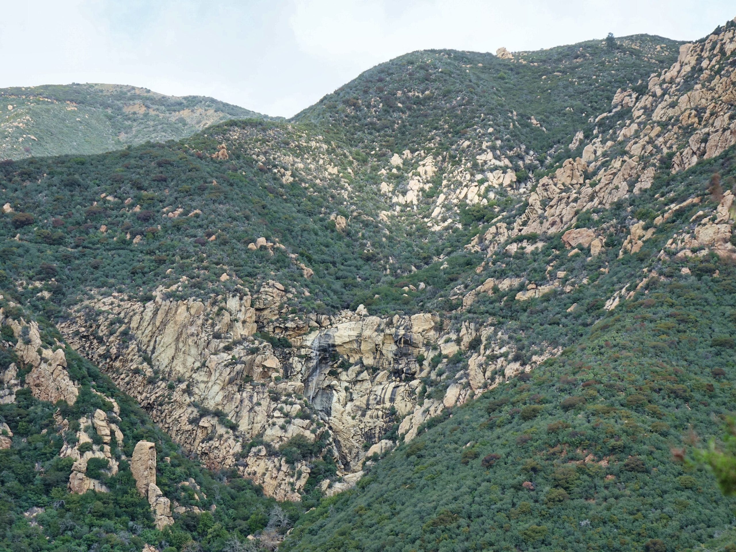
Here is a closer view.
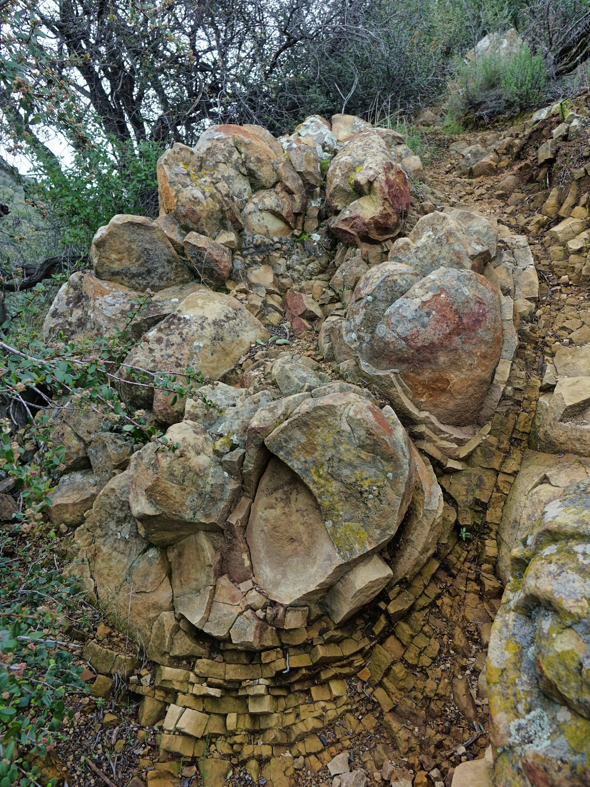
As we scrambled up to Mission Ridge we encountered several of these beautiful geological oddities.
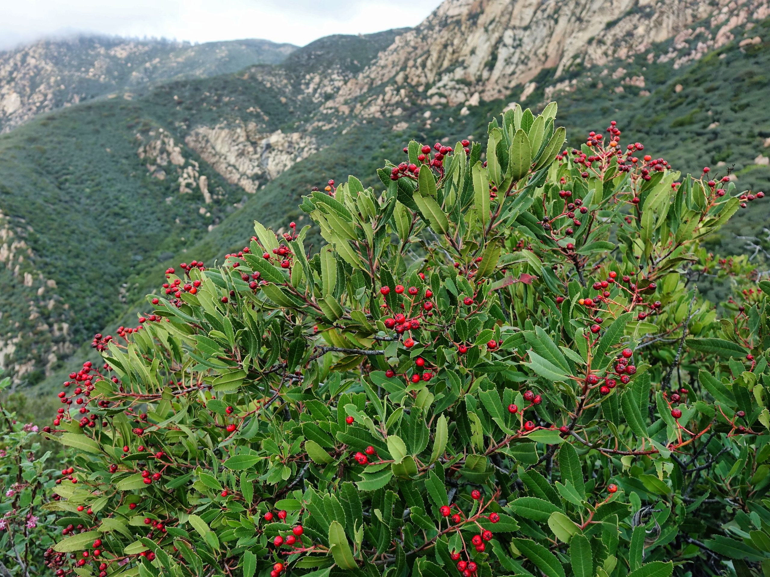
We also encountered toyon berries. These are edible, but they don’t taste very good!
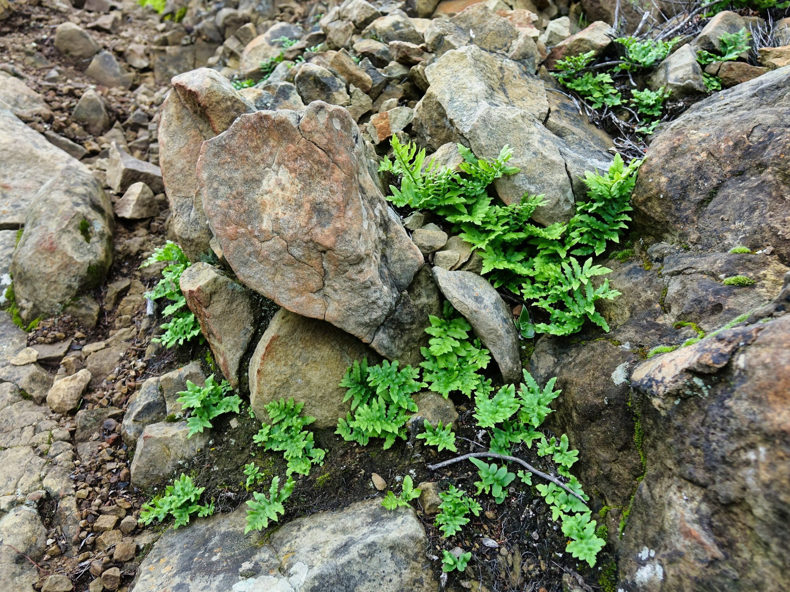
Ferns and moss nestled among the rocks, too.
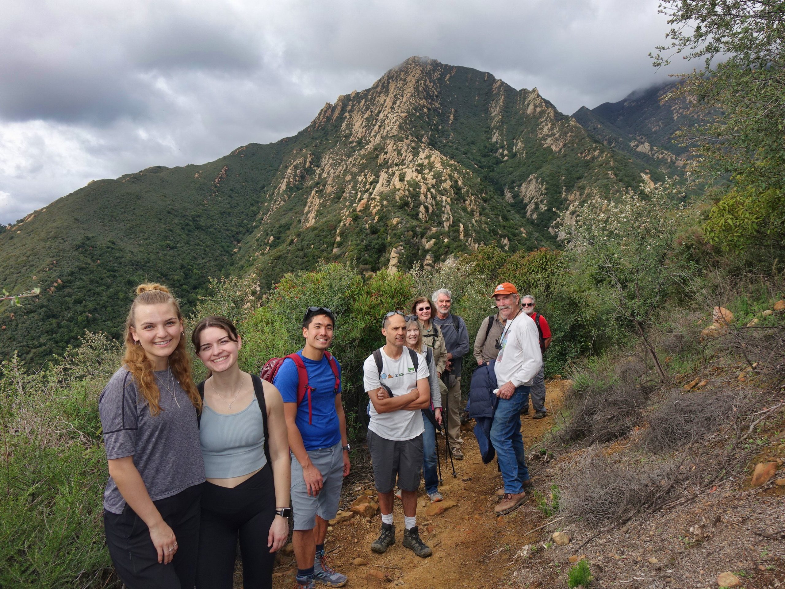
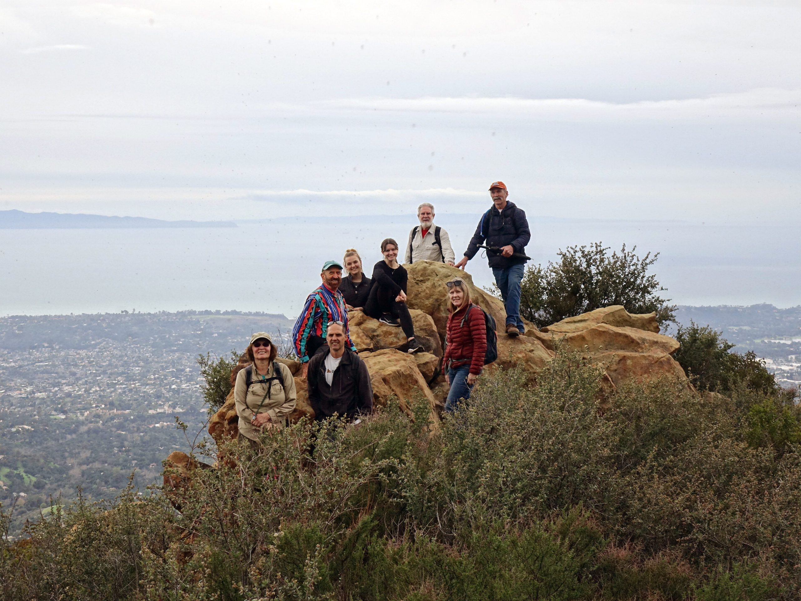
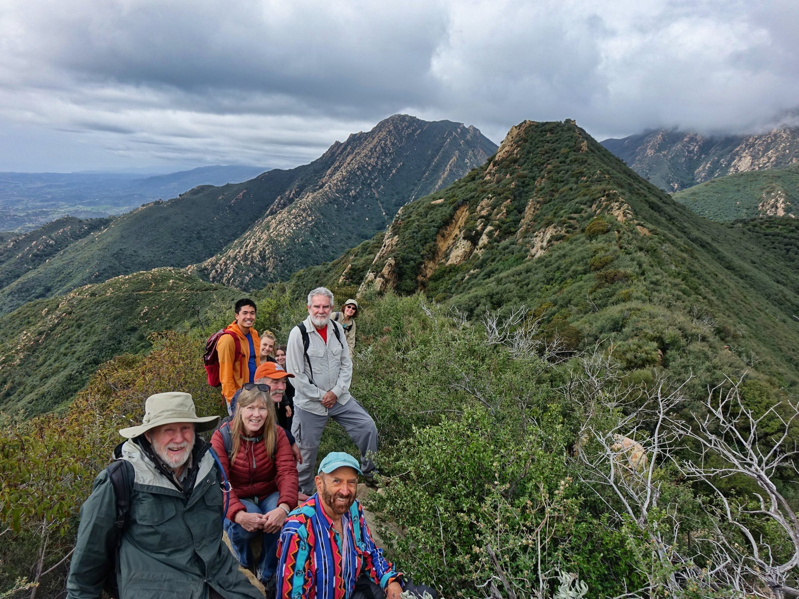
Here we paused for a group photo as we were most of the way up the ridge toward our lunch spot.
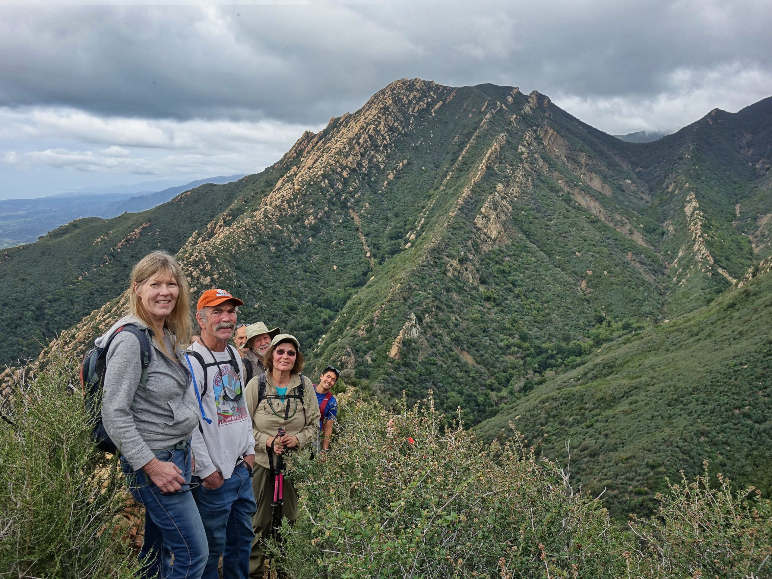
In front are Cathy and Jim. They kindly invited us on a future hike on their property in the mountains. That will be a future article! Toward the back of the group is Chris, in the blue shirt. He had just arrived the day before from Massachusetts. He is a fellow MIT alumnus and he had just moved out here to start a new job. He had not even unpacked or been to his new office yet, but he was eager to get out on the trail! He was a hike leader back in Massachusetts and, if we are lucky, he may lead hikes for us here!
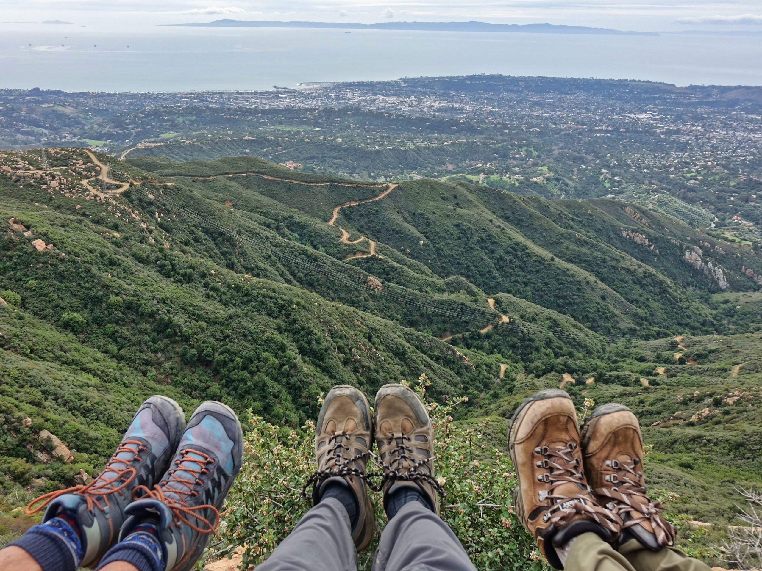
Soon, we were on top of Mission Ridge. Relaxing, enjoying the magnificent views and having lunch. Three of us dangled our feet over the edge! You can clearly see the Edison towers and the service road where we would later descend.
When we finished lunch, we had to pose for some group photos at the top of Mission Ridge!
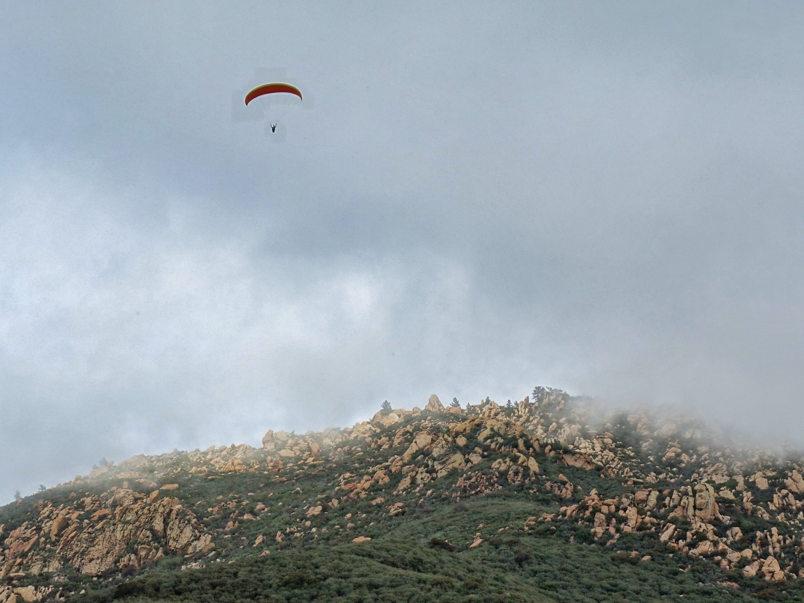
Then came the adventure of crossing all of Mission Ridge. There is a primitive trail across most of it, but a pole definitely helps in places. And now we were up close and very personal with the paragliders!
This one is above what we call Rocky Pine Ridge and what some others call The Rock Garden.
Here we paused at a local high point along Mission Ridge. Our lunch spot was on the next peak. And you can see Arlington Peak beyond that.
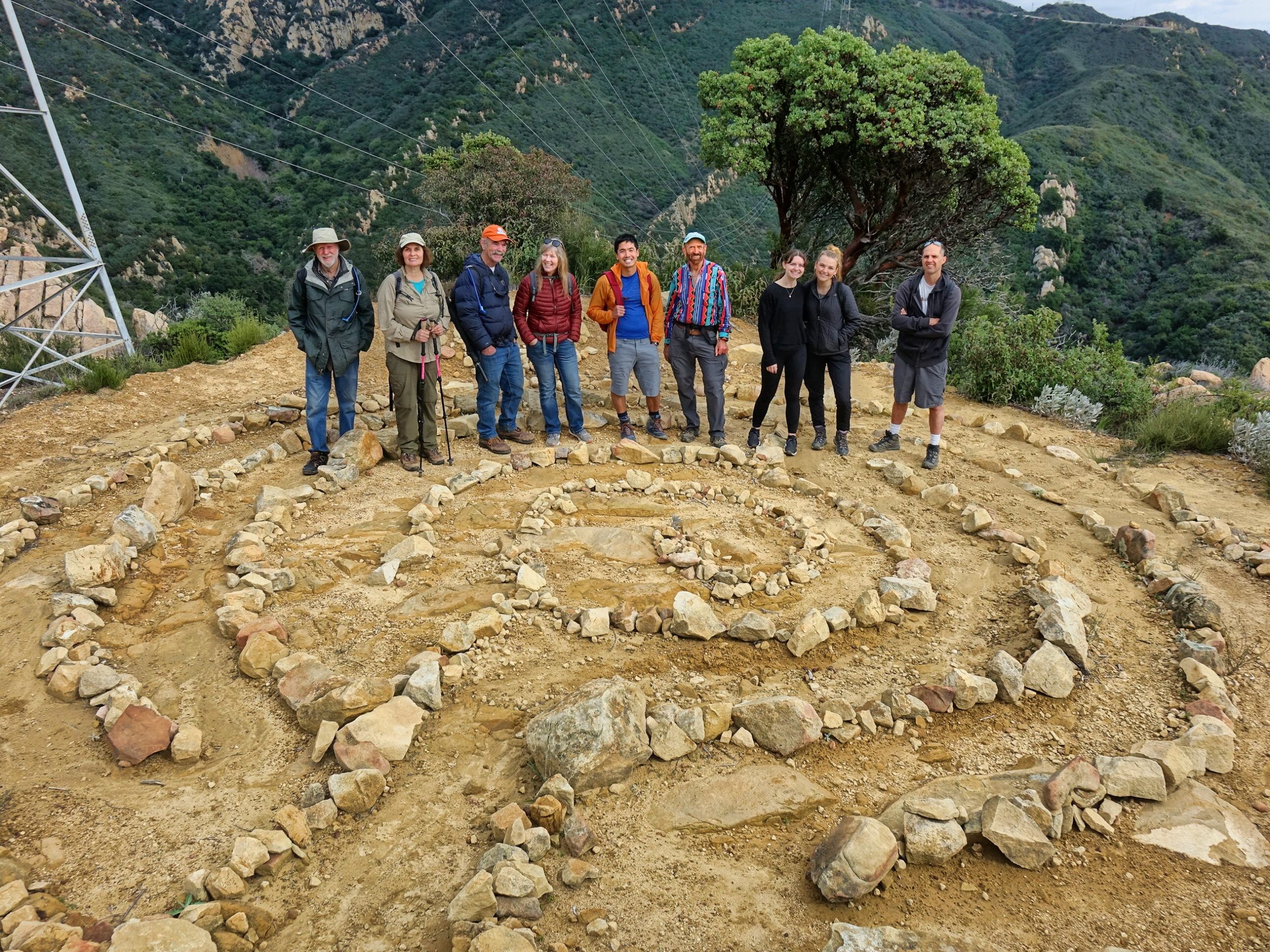
At the end of Mission Ridge we dropped down to the top towers on the Edison Service Road. Where someone has created and maintained a lovely labyrinth! We met a mountain biker up there who had made a wrong turn. But he kindly took our photo!
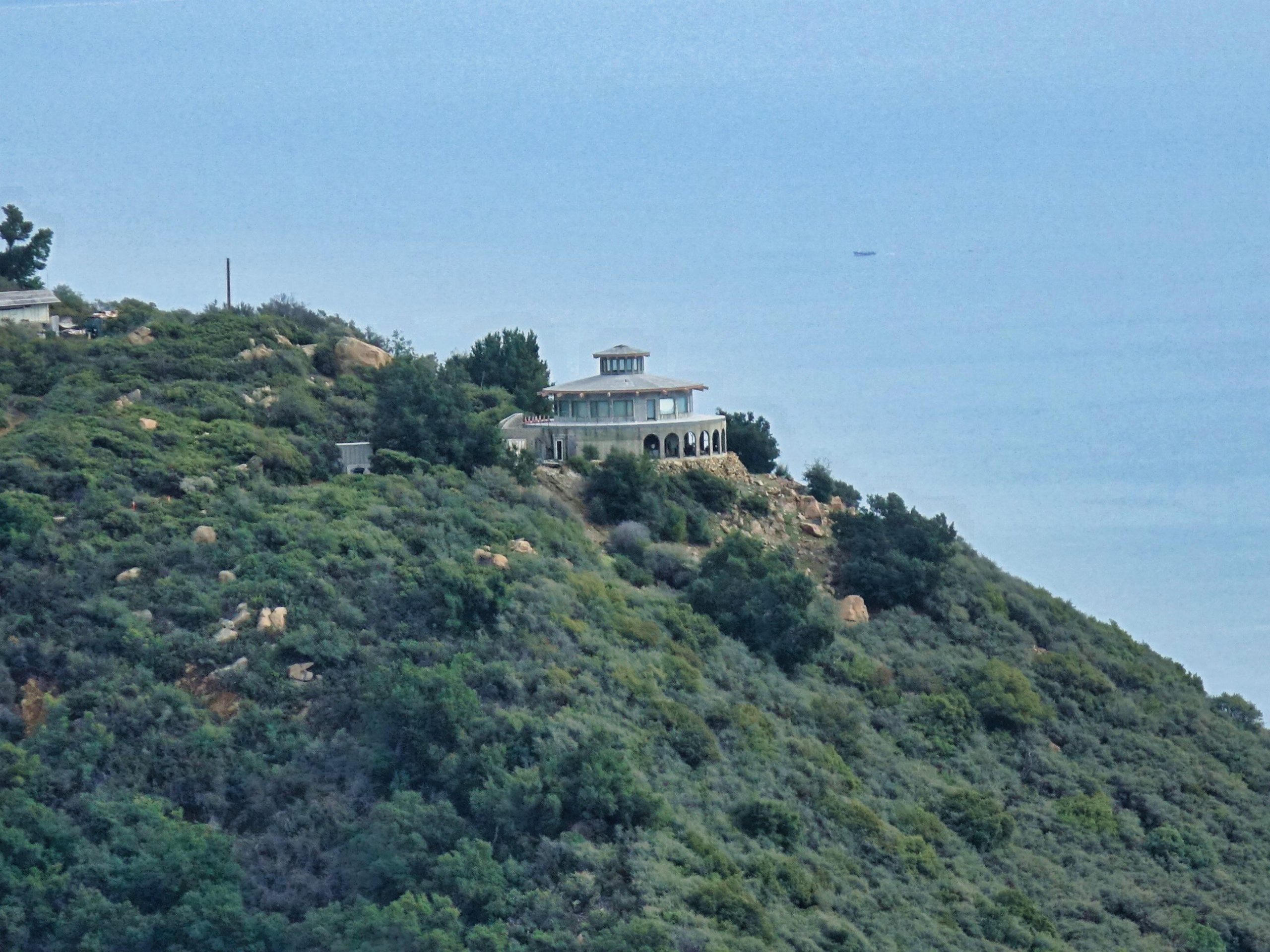
As we descended on the Edison Road we got a clear view of the fascinating round house on Gibraltar Road.
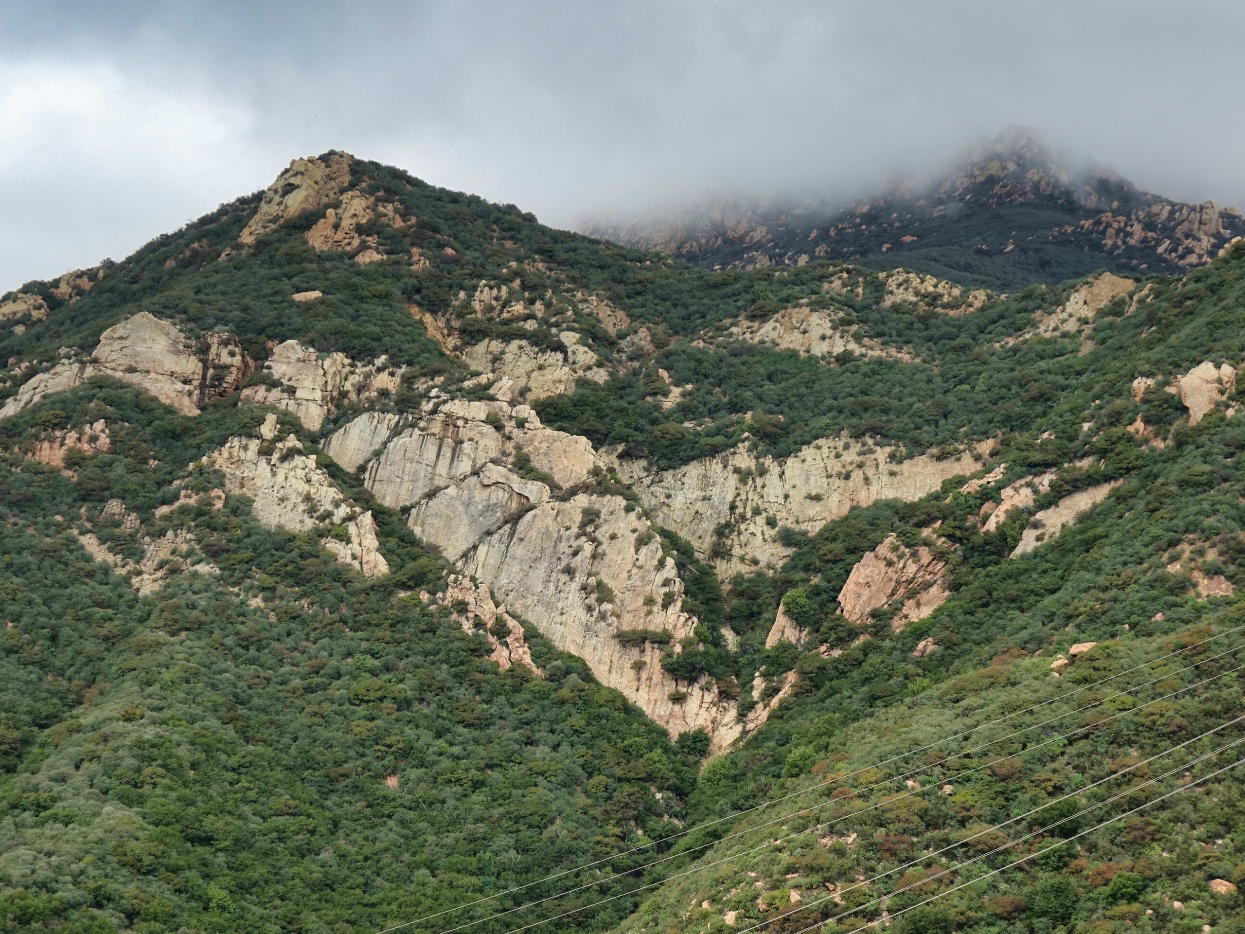
Here we got a clear view of Mission Ridge, where we had just been hiking. Our lunch spot was at upper left. Rocky Pine Ridge is above it in the mist. And below that is a sheer rock face. For many years there was a peace sign that someone repainted periodically. It is getting quite faded and difficult to see.
We got down before the storm and everyone was very happy!
You can see the schedule of all of our local Humanist Society hikes and other events here on Meetup. Everyone is welcome!
https://www.meetup.com/
– Robert Bernstein


Really nice pics of the front country mountains!
Appreciate the detailed descriptions of each area.
Thank you for the kind words, halibut52. I am grateful to all of the people on the hikes who I learn from. As I noted, geologist Tom Farr is a wonderful resource. He is the guy in the red shirt in this photo.
https://www.edhat.com/wp-content/uploads/2024/02/20240203-026-scaled.jpg
I feel very grateful every day to live in such a uniquely beautiful place on Earth.