

By Pat Fish

The Santa Barbara County Trails Council has been working for the past several years to open up this jewel of a trail for the public. Finally it was time to go explore it!
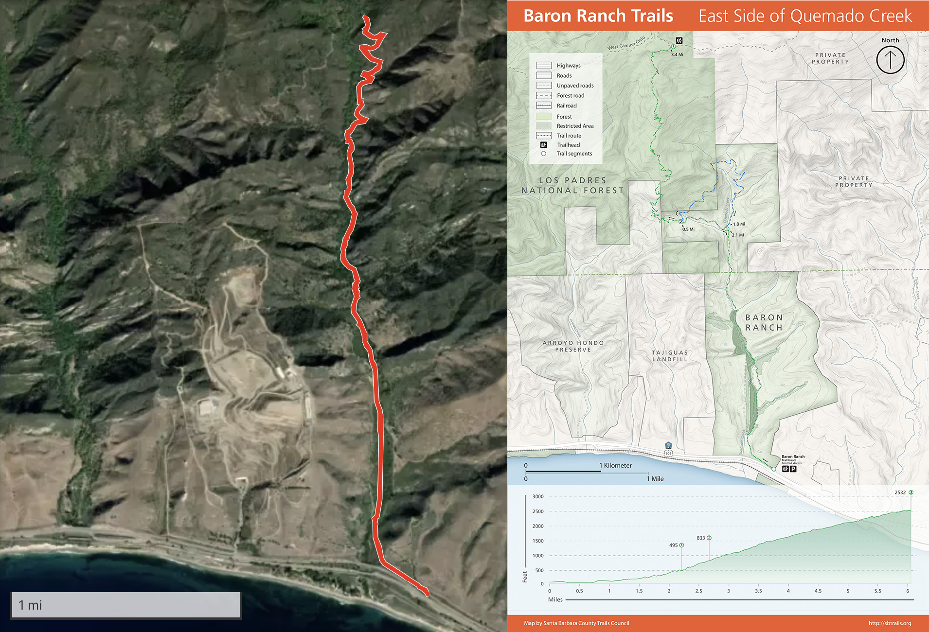
Getting there is easy, but there is no signage off the 101. 24 miles north of Santa Barbara and 2.4 miles past the Refugio Road exit turn right at the road crossing onto Arroyo Quemada Ln. Immediately turn left onto Calle Real and proceed approximately .75 mile until the road reaches a street sign that says “End”. Use the circle to turn around and park along Calle Real.


There was plenty of room between the hikers’ cars for our rigs.


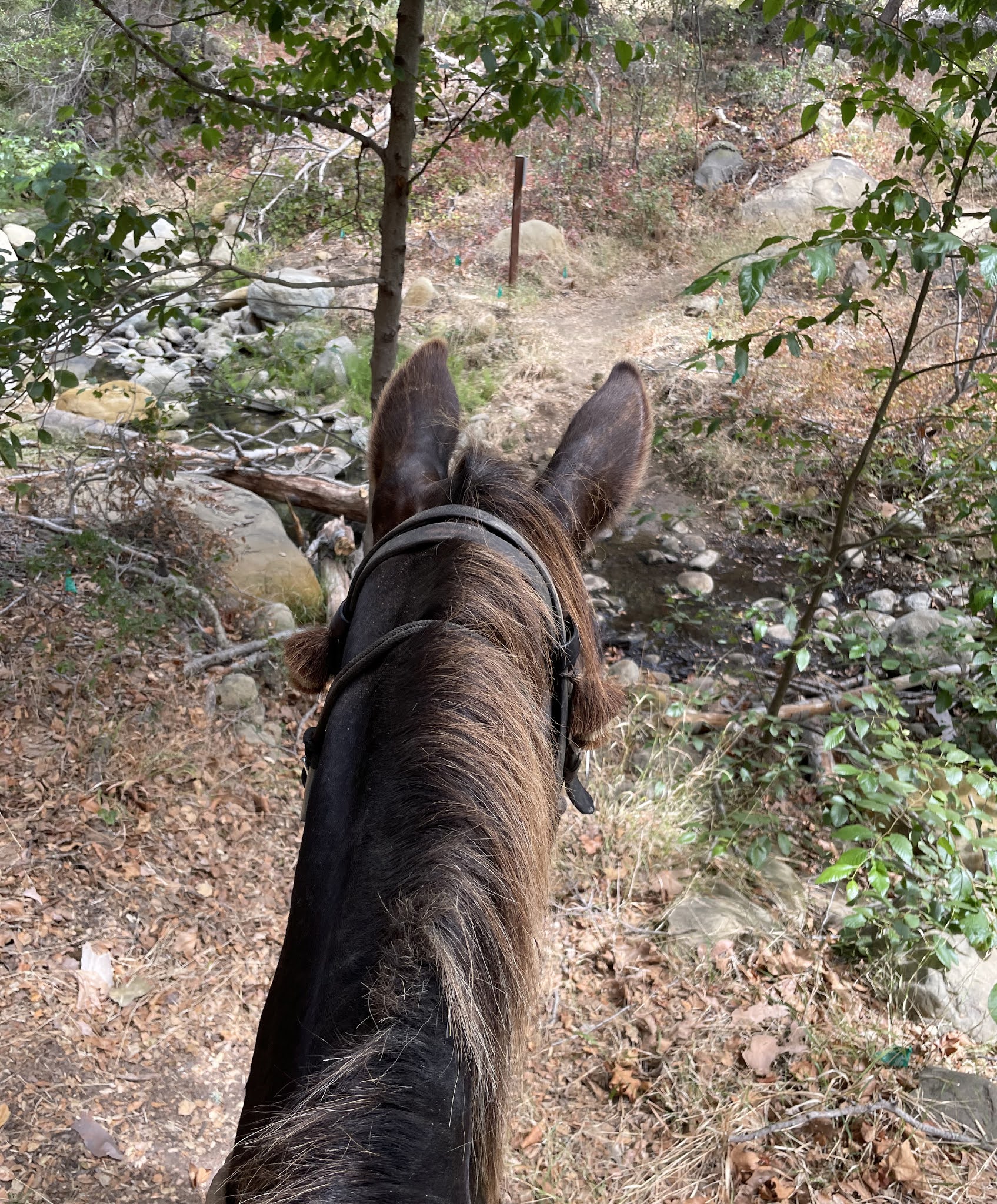
We opened the side gate and the animals stepped through and we were off onto the trail system.

All I knew was that there were two trails. a 6 mile and a 12 mile. Turns out the Arroyo Quemado trail leads directly up the canyon, then you come to a split. There you can decide to do the East or West Loop trail, which just means you travel the same trail clockwise or counterclockwise, or you can take the West loop and that will lead you to a trail that will go all the way up to Camino Cielo at the ridge top.

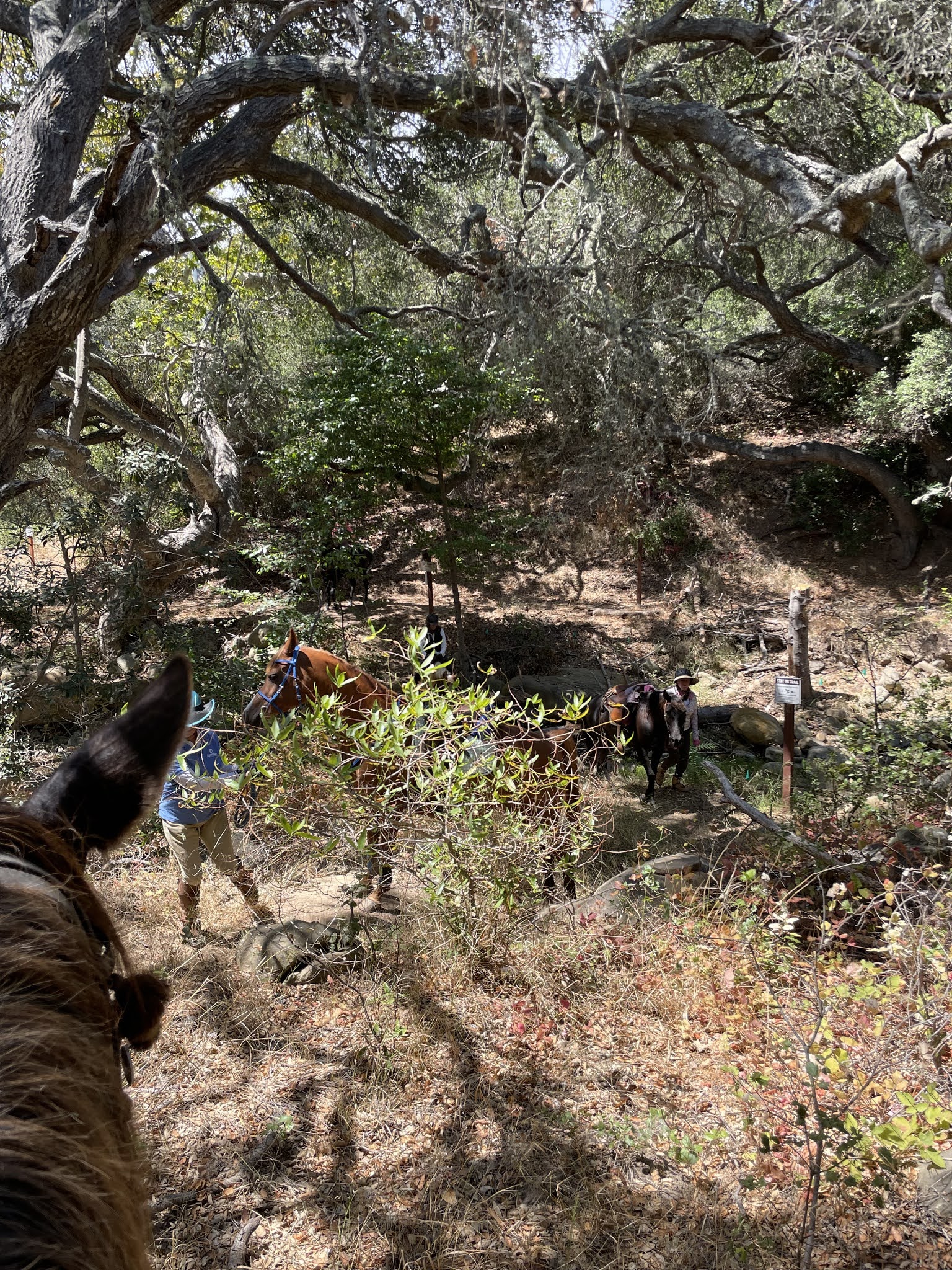
We had 5 ladies, 4 horses and Tobe Mule. And a dense coastal fog that cooled us at sea level.
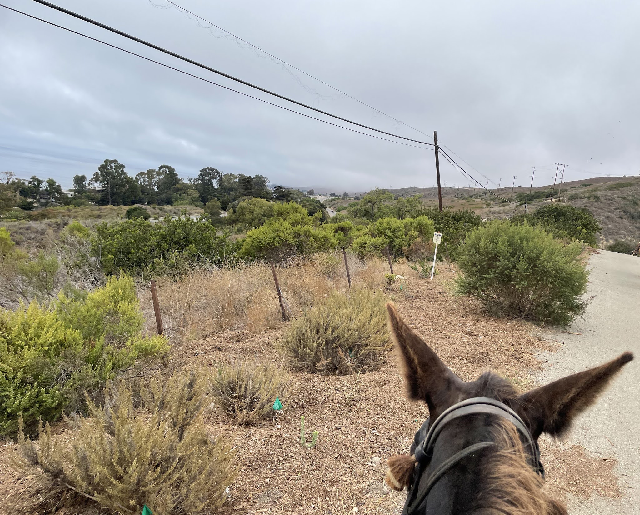
None of us had any idea what we would see, but anyone who comes on MeetUp rides knows to expect that! I had read the trail description, but I was just out for landscape and time with my mule, so we headed up into the unknown.

We immediately saw fenced off machinery. I remembered that I’d heard the opening of the trail was greatly delayed by the expense of sturdily surrounding these pipeline devices. I believe they have something to do with a nearby natural gas refinery.

There were numerous interpretive signs that were at hiker height. I hope someday they will post a second set at a height equestrians can read.
Part of the trail was overgrown with tumbleweeds, and part seemed to be going through an abandoned avocado orchard.


At regular intervals there were signs insisting that we stay on the trail. No problem.

The cracked adobe mud in the trail was enough to pay attention to without bashing through the poison oak !

Of course, mules are famously sure footed.
The only problem was that tender green tumbleweeds are one of his favorite snacks.
A distraction from the task at hand: climbing the mountain.


There were a lot of broken PVC irrigation pipes left over in the trail, presumably from previous agricultural endeavors.

We encountered less than a dozen hikers, all of them very pleasant.
And thankfully the only bicycle rider we saw was just leaving as we arrived.
This trail would take some stamina to hike, but is well worth the effort.

As we headed up the fog bank seemed to rise

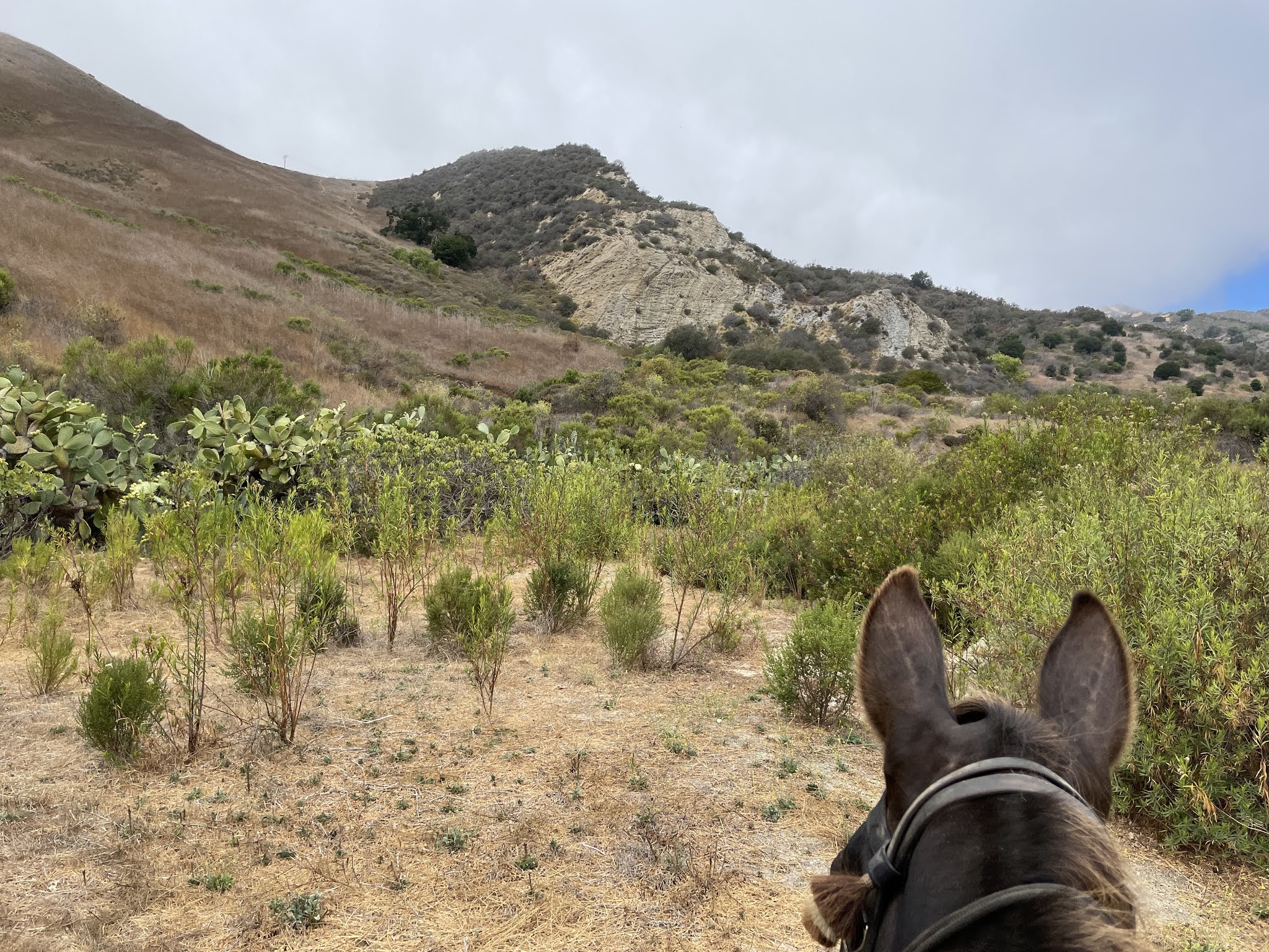
Until the trail opened up and we could see this lovely landscape.
If you look at the map above you’ll see that on the other side of that ridge is the Tajiguas Landfill, an entire canyon presumably once as lovely as this one filled with garbage from the city. Amazing, to have chosen such a spot for the dump.


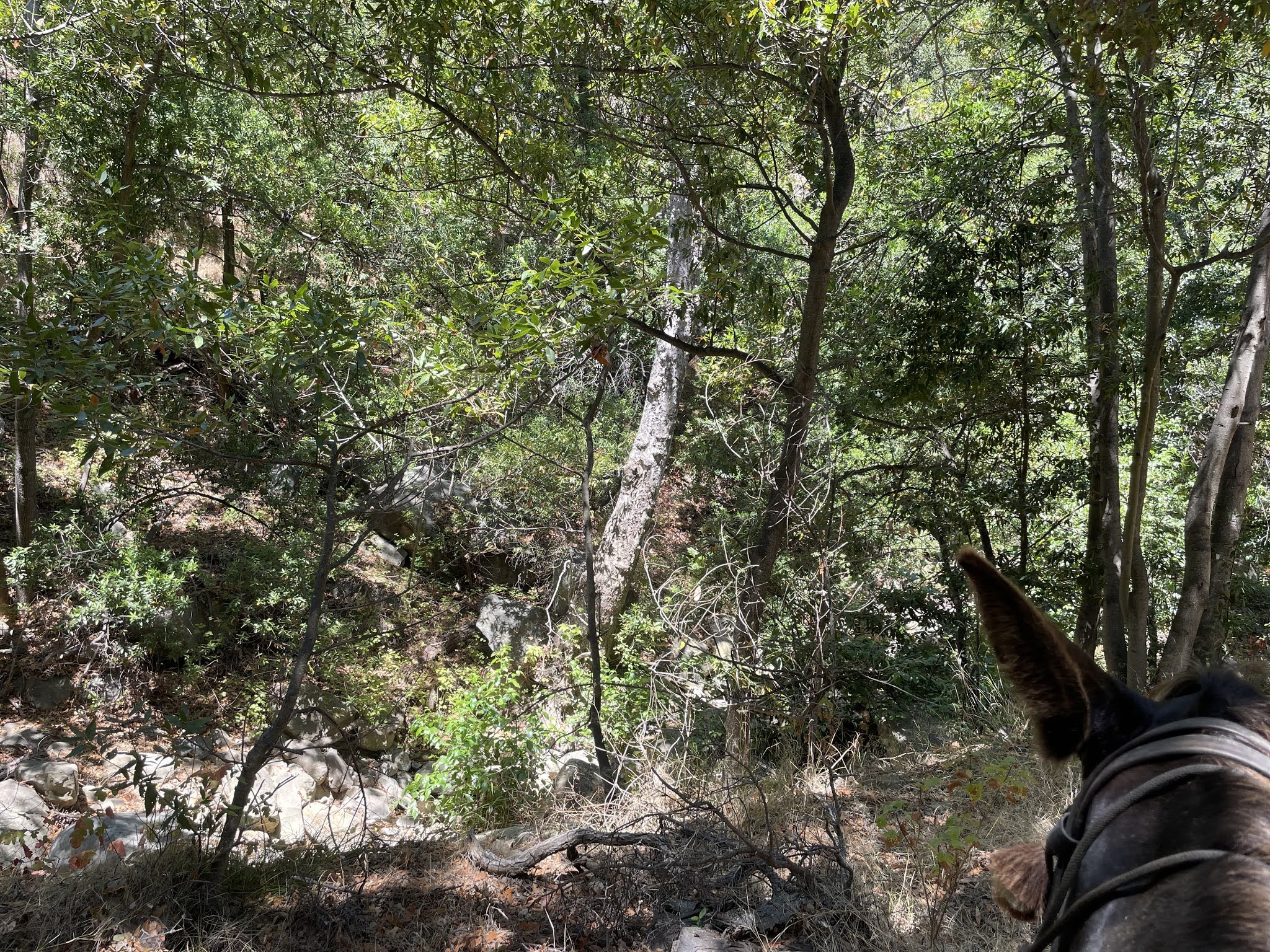
Then the trail followed the route of the creek up into well forested areas.
On a day when it was 90 degrees back in Santa Ynez we relished the shade and cool air.

And the few people we shared the trail with were all very nice.
What a wonderful public resource this park is.

Over and over we saw these highly fenced pieces of mysterious equipment. Just a little jarring out in the wild.

The area immediately next to the path is impenetrable brush, lush and healthy and definitely not inviting to go stray off track to explore.

Then we came to the point where the trail crosses the creek, and where the Trails Council has installed a “critter cam” to record the passing through of wild life.
Tobe being a sturdy and sensible fellow led the way and set the example for the horses, walking across the tiny rivulet without hesitation.

But then, all the horses refused to cross it.
Tobe and I waited, and watched, as the gals tried to convince their horses that this was no big deal.
Seriously, it was 6″ deep.

Some, with horses they could not ride across, decided to walk through and lead their mounts.
I thought this was strange, knowing the story of a good friend who once did this and had the animal jump onto her and break her ankles.
My job is to ride Tobe Mule, his job is to place his feet safely to get us where we want to go.
But soon all had crossed and we were off again.


On what would otherwise be a hot day the shade was very welcome.

I felt like I was a kid back at summer camp hiking.
AND THEN
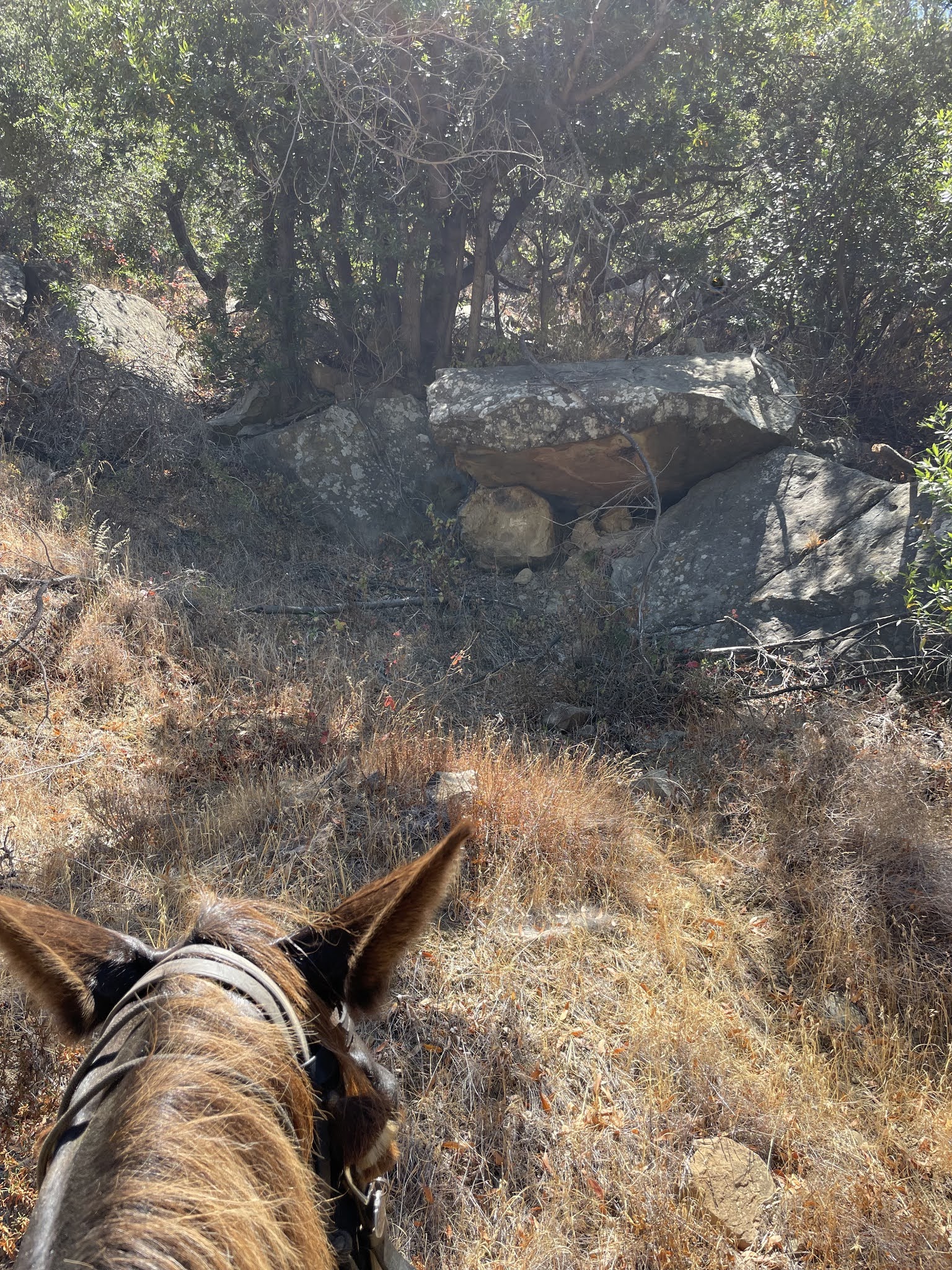
I felt like I was back in Ireland. This rock formation looking so much like the dolmens that dot the landscape there.
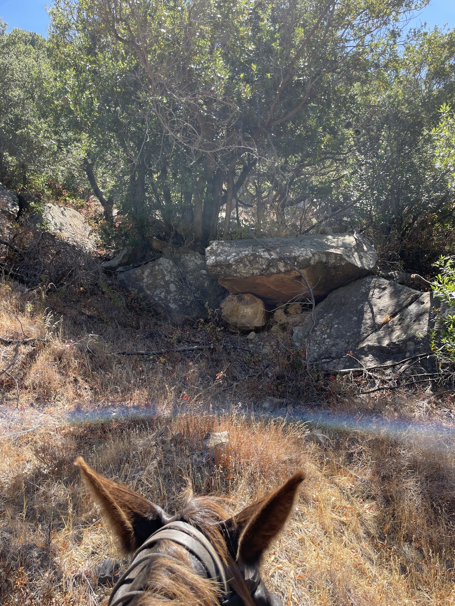
And as I remarked on the resemblance to a Celtic cairn for the Dead

We left those Spirits to their slumbers and continued on.

We soon came to the split in the trail. I left it to the others to decide which way to go and they chose to the right, the East Loop.
If you look on the map above you can see that took us straight up, with lots of switchbacks and twists in a very steep trail up the mountain.

Here again there was a signpost, a map at hiker height, and frankly we couldn’t make hide nor hair of it.
So we soldiered on, blythe spirit.

The first section was tame enough, not much different than what we had been passing through.

The trail a little less well maintained, more deep ruts and more fallen branches in piles.

But what views! The multiple species of plants in this mixed forest allowed for every turn in the trail revealing a different mix, and here there was a stand of yuccas on the top of a ridge like a crown.

This massive fallen pine, too big to remove, was trimmed and made into a fence on the side of the trail.
Big thanks for the Baron Ranch trails being maintained by the Santa Barbara County Trails Council in partnership with the County of Santa Barbara Community Services Department, Parks Division.
But then…

We came across this unusual building. By press time I was unable to discover anything about it.

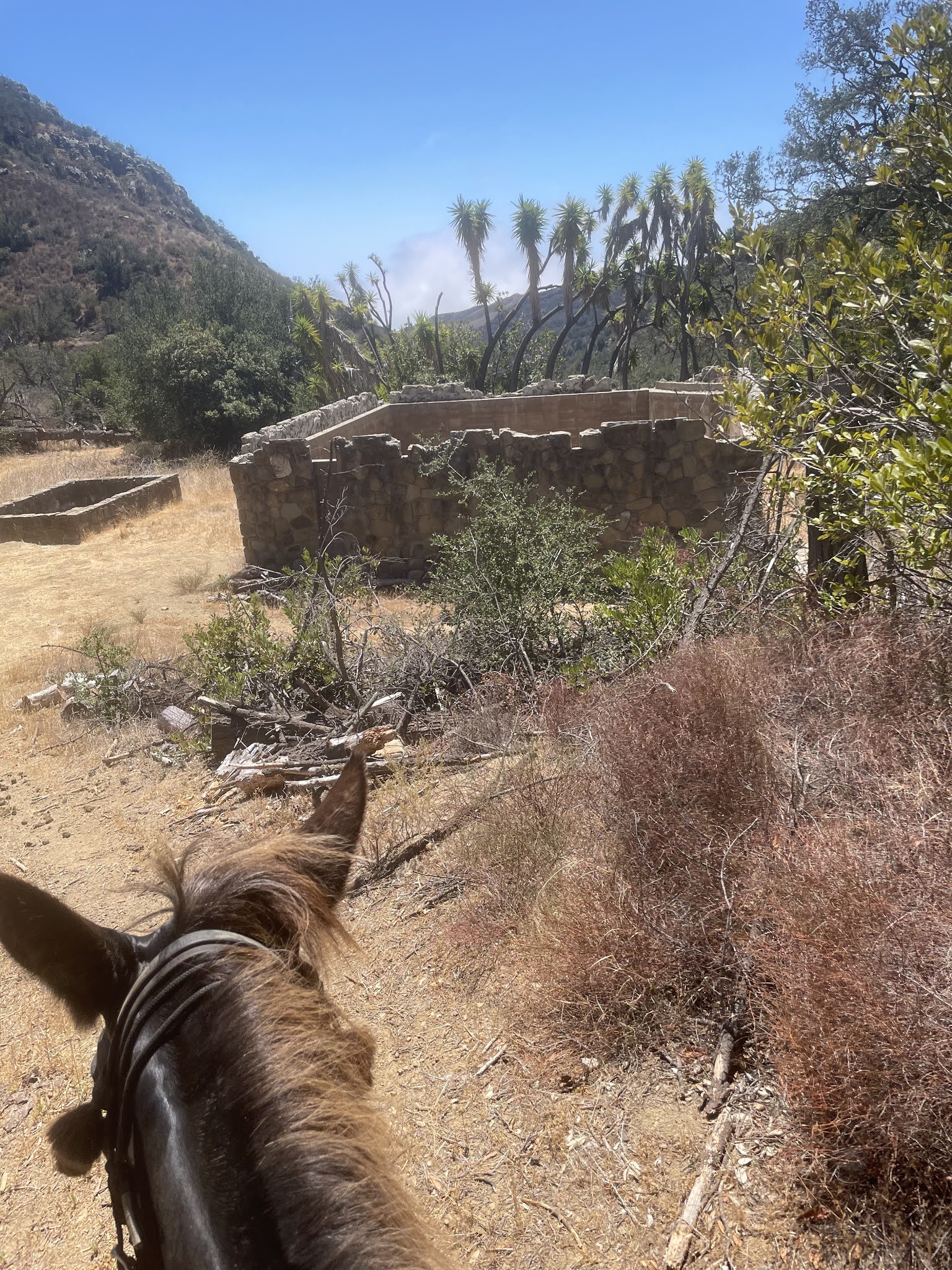
It looked like it might be recent to me, the inside was cinderblock and the outside surface made of stone. But there was speculation that the cinderblock might be serving as reinforcing for an old structure.

In any case it looked like the perfect frame for a group photo.

Pat on Tobe, Jamie on Mosca, Marsha on Jackie Jo, Debi on GiGi, and Gabriella on Sweetie.

Then we ran into this helpful couple who told us the trail up ahead was “not so steep” and “really pretty.”
Encouraged, we let the animals do all the work and kept going UP.

Not too steep? Are you kidding?
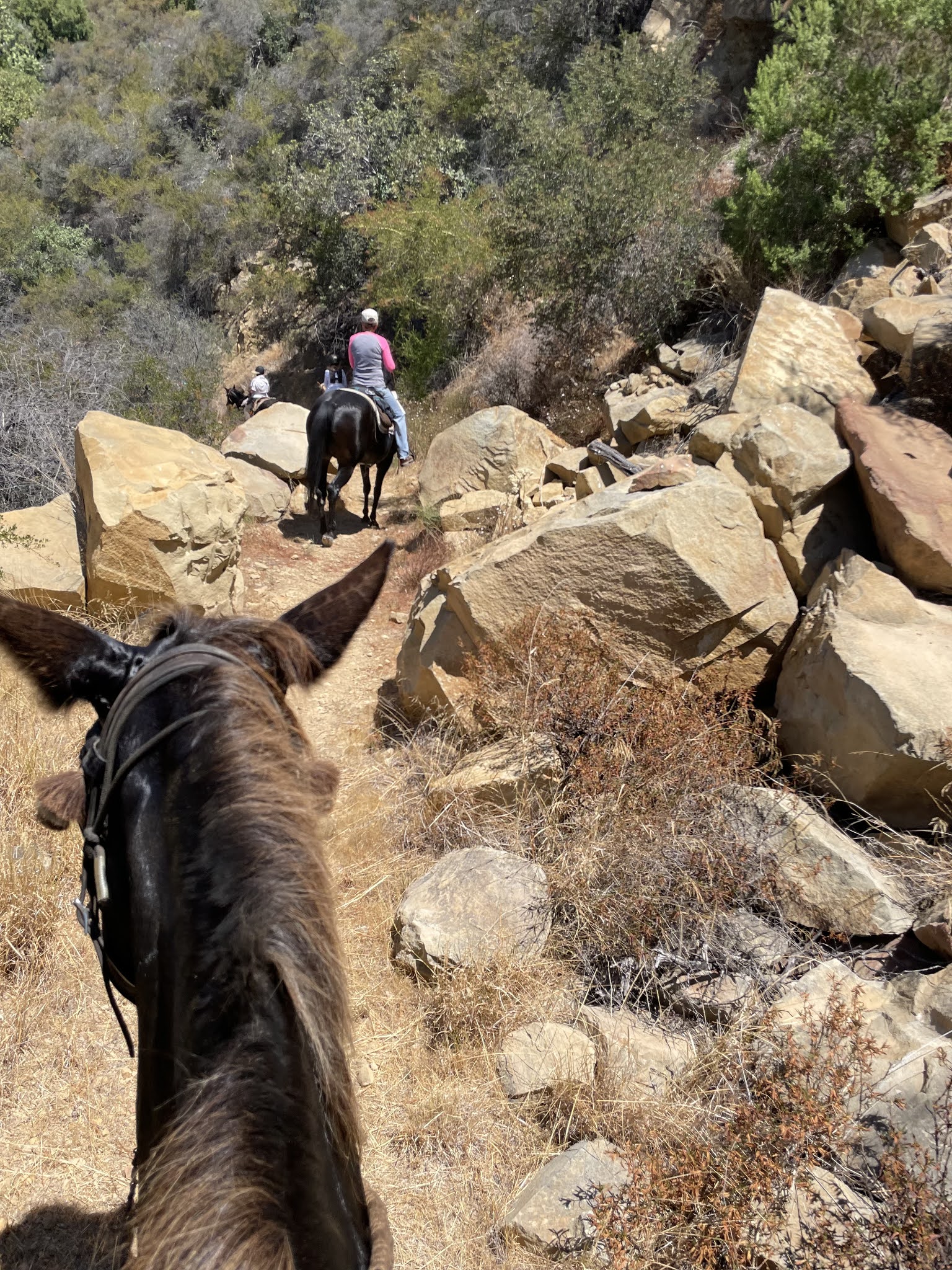
The animals threaded their way through the landscape of boulders, the trail would go flat or down and than wham, steep back up again, doing switchbacks steadily up.

Until finally we reached a point where the view was worth all the effort. There 1200ft below us was the blanket of coastal fog we left behind, and the landscape we had traversed to reach the heights.
Then the front rider said she’d reached a trail obstruction she could not get past, so we all made a pivot and retraced our steps.
On the way back down….. visualize a reverse of the same, including another big delay and drama with horses who didn’t want to cross the stream.

Why doesn’t everyone ride a mule?
I’m sure glad I do.
Maybe this MuleTrail Blog will inspire others to!


The reason why there aren’t interpretative signs at 10’ for horse riders only is because hikers couldn’t see them. Newsflash, there are more hikers than riders on our trails. Sorry, can’t make things perfect for everyone. Only so many dollars to go around.
Thanks Toby ! Looks wonderful !
(Duh – Toby is the mule and Pat is a fish ?)